Hello,
After seeing a few posts about Radio Frequency Interference (RFI) recently here, I thought I’d share something I’ve been working on.
Rather than applying a full mitigation algorithm on Level-0 (raw) data, this approach starts from Level-1 SLC data. Instead of completely removing the RFI from the SLC, the idea is to generate multiple lower-resolution sub-images where the RFI is located at different positions in the image, allowing previously obscured areas to become visible.
This relies on two techniques which are range frequency sub-banding and Doppler sub-aperture decomposition. Depending on the bandwidth of the RFI one of those two would be more suitable.
Narrowband interference (NBI) which occupies only a small portion of the SAR bandwidth. For this type of RFI range frequency sub-banding works best, causing the RFI to appear at different range position on the image depending frequency partition being observed.
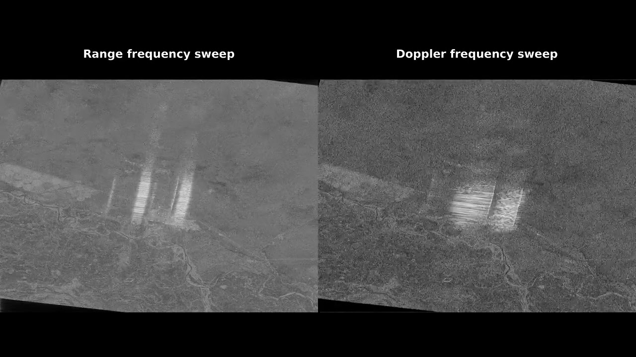
Wideband interference (WBI) which occupies a much larger fraction of the bandwidth. In Sentinel-1 images, these will usually appear as bright stripes covering an entire burst. In Sub-aperture images, the interference can shift up and down along the azimuth direction.
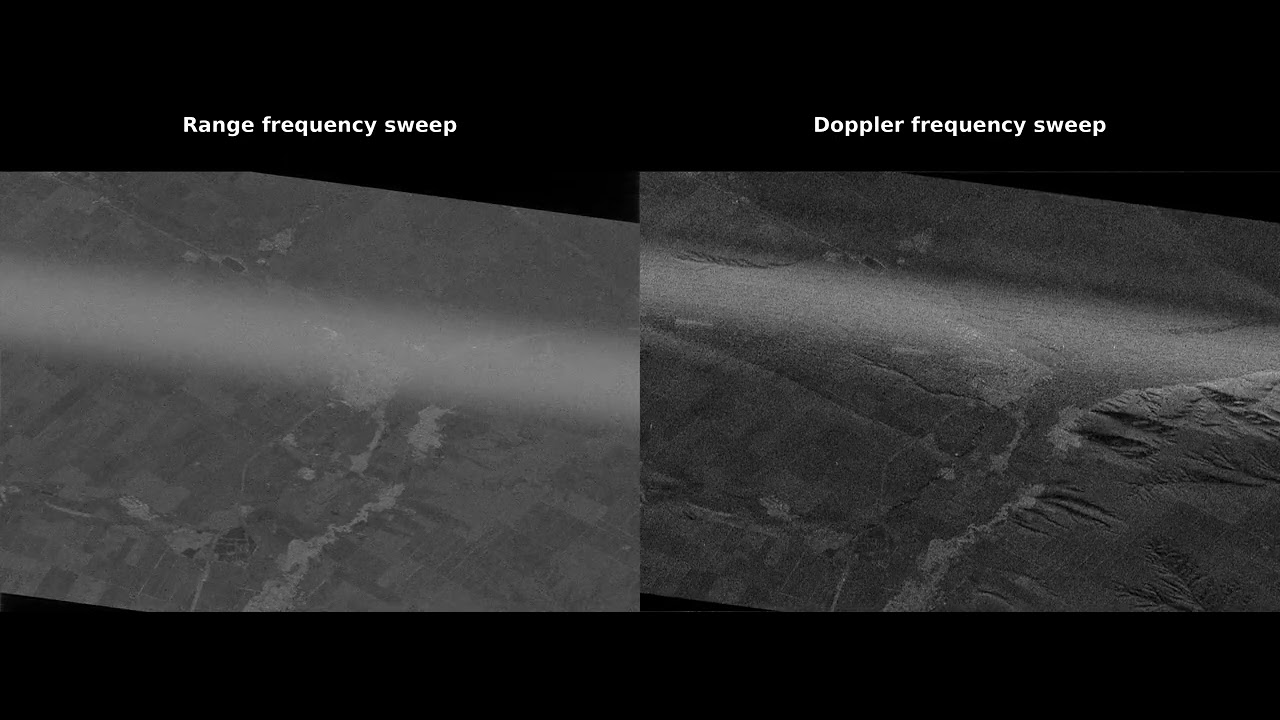
So far what I’ve been doing is first generate a series of sub-images using a small window fraction with a large overlap between them. This produces a fine sweep across the spectrum, useful for identifying exactly which frequency range the RFI occupies. Once the contaminated portion of the spectrum is identified, a final sub-image is generated using the largest possible window that avoids the contaminated band.
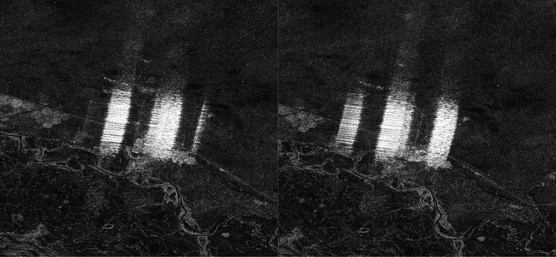
The pre-processing is done in SNAP. The most important step is the TOPSAR Deramp-Demod, once exported as a complex GeoTIFF the rest of the processing is done in Python : sar-rfi-spectral-analysis/sar_rfi_spectral_analysis.ipynb at main · mikhelif/sar-rfi-spectral-analysis · GitHub