This indicates that the module didn’t produce correct results. Is the offset image reasonable? A lager screenshot of your data would help us to understand it better.
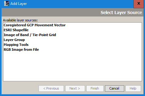
The “Coregistered GCP Movement Vector” does not display the results of the offset tracking tool. It shows the shift of the slave image resulting the coregistration and was already created before the offset tracking.
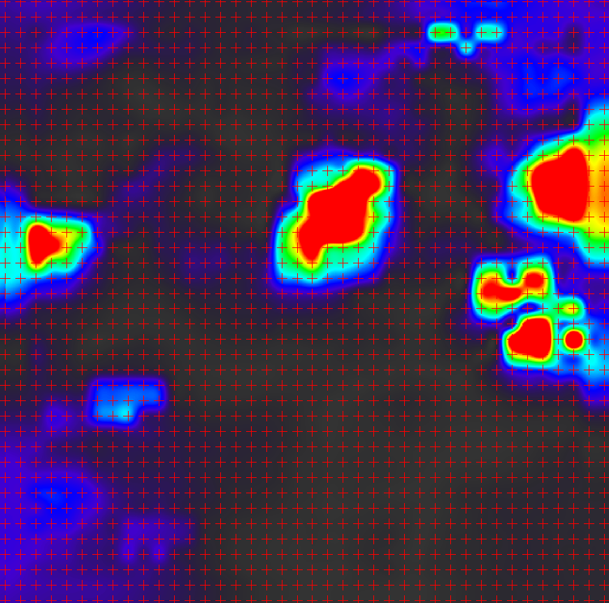
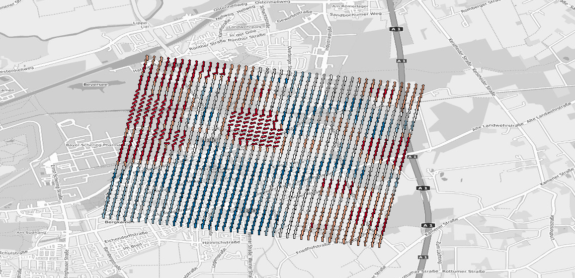
If this is your velocity map, the red crosses indicate where the displacement vectors are located
But you are right, there is no longer a map element for the results:
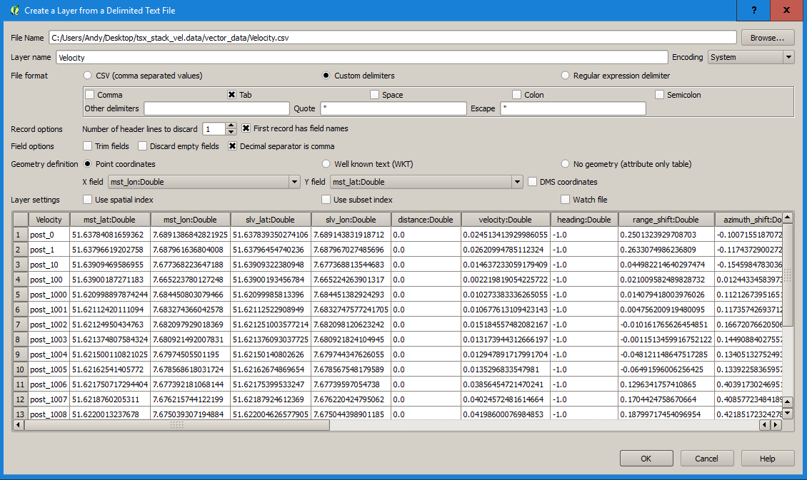
You can however open the generated file velocity.csv (in the data folder > vector data) in a GIS and display it based on the attribute columns:
2 Likes
I’m fascinated to know what was moving in this urban area please (with enough velocity to be detected by Offset Tracking)???
Many thanks
Andy
I believe that is not real movement but a display of “Coregistered GCP Movement Vector” as explained by @ABraun above.