Hi Greeting to allhttps://ncss.hycom.org/thredds/ncss/grid/ESPC-D-V02/ice/2025/dataset.html )
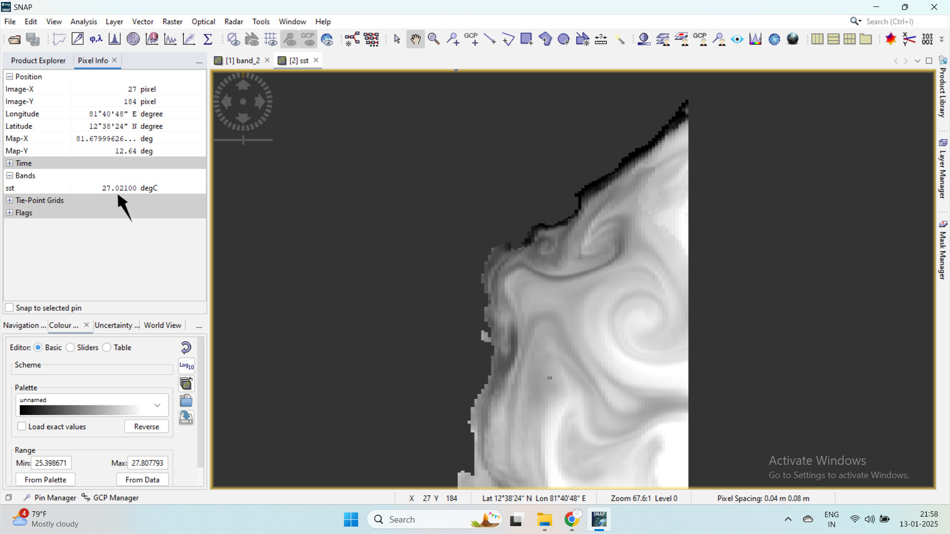
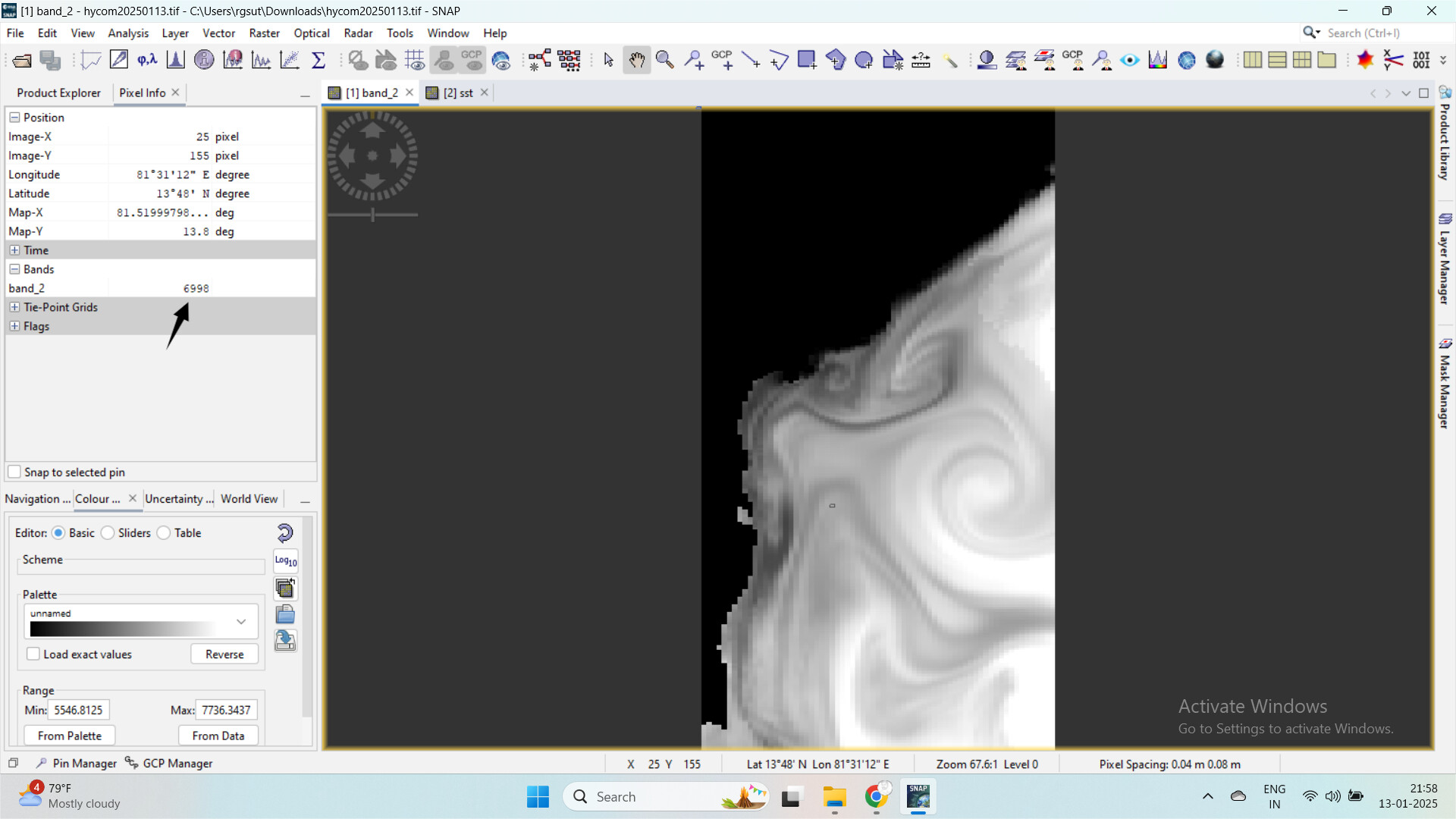
After I loaded that nc file in SNAP (which was clear sensible pixel value )
The second step I tried to convert nc file to GeoTIFF format. After then my sst band value i had peak
This issue happen on all the band SSS, SST, , u, v
I hope this can be solvable , Thank you for your time
The cause is probably that SNAP stores in GeoTiff files only the raw values.
I have explained possible solution here:
Thanks for the details.
You export B4 and B8 to GeoTiff and then calculate NDVI in Python/Matlab.
So, the issue is with the export to GeoTiff and not the calculation of NDVI in SNAP. And this issue is more than 15 years old.
When exporting to GeoTiff only the raw values are exported.
You can see it in the screenshot. QGIS show UINT16 as data type.
[image]
This was a wrong decision event though there where good reasons to do so at this time.
You have 3 options, I think.
Not using GeoTif…
In GeoTiff only the raw data is stored which is uint16 for S2 data. Unfortunately, there is no standard to specify scaling factors in GeoTiff.
You can create new bands based on original ones by using the Band Maths.
This will apply the scaling factor and convert the data type to float32.
[image]
Make sure to uncheck the Virtual option.
Afterwards you can delete the original bands.
When you now save the data to GeoTiff the data is scaled.
This is annoying work in the GUI for many products.…
1 Like
Good Morning
Thanks for your time, Yes I applied scale factor and addoffset Now get reliable pixel value
Hi greeting to all
I have strange chl_oc4me band value after convert geotiff.
I converted to this file band named chl_oc4me
After convert value like this
I dont know what scale factor apply for chl_oc4me band , If know anyone kindly mention my mistake
Thank you
muskan
January 16, 2025, 4:54am
5
Hi everyone, thanks for the detailed explanations so far. For the issue with the chl_oc4me band values after conversion to GeoTIFF, have you tried checking the metadata in the original .nc file for any hints about the scale factor or offset? Sometimes these details are embedded in the file attributes. If not, tools like Python’s xarray might help inspect the file contents.
You can find the scale and offset value in the information window. Select the chl_oc4me band and open the information window.SNAP Online Help
If you use BandMaths to create a copy of the original band, you don’t need to know the values. They are applied automatically.