Hi all,
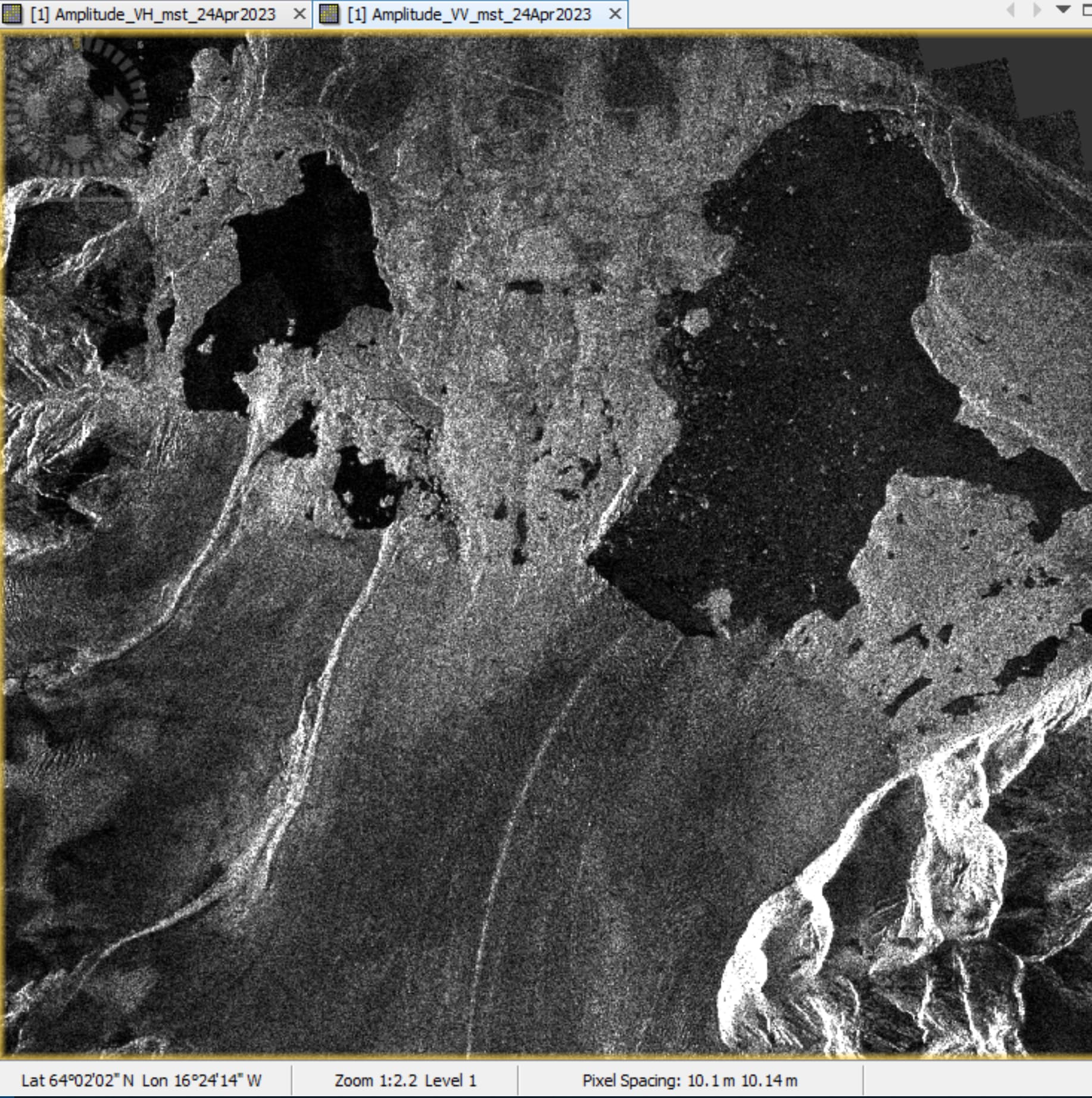
I am using the newest version of SNAP to follow a glacier surface velocity tutorial (How to Create Glacier Velocity Maps with Sentinel-1 Toolbox | Alaska Satellite Facility) to look at the surface velocity of Breidamekurjokull’s calving front in Iceland over 12 days from April 24, 2023, to May 6th, 2023, using VV polarisation.
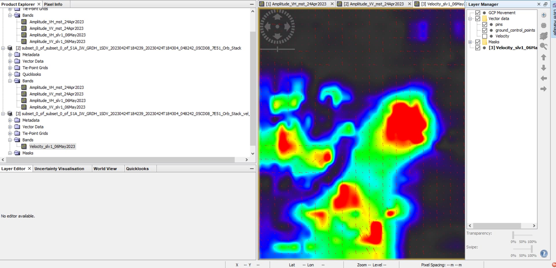
I followed all steps thoroughly, first starting off by applying the orbit files to both the master and slave files. Then I coregistered both orb files into a stack with the DEM Assisted Coregistration with XCorr tool, making sure the oldest file is first, and used the Ace30 DEM. After that ran, I took the stacked orb file and created a subset of just Breidamekurjokull. From the subset file, I used Offset Tracking, inputting 3.5 m/day as the maximum velocity, as I found this number in a couple of research papers on Breidamekurjokull’s surface velocity.
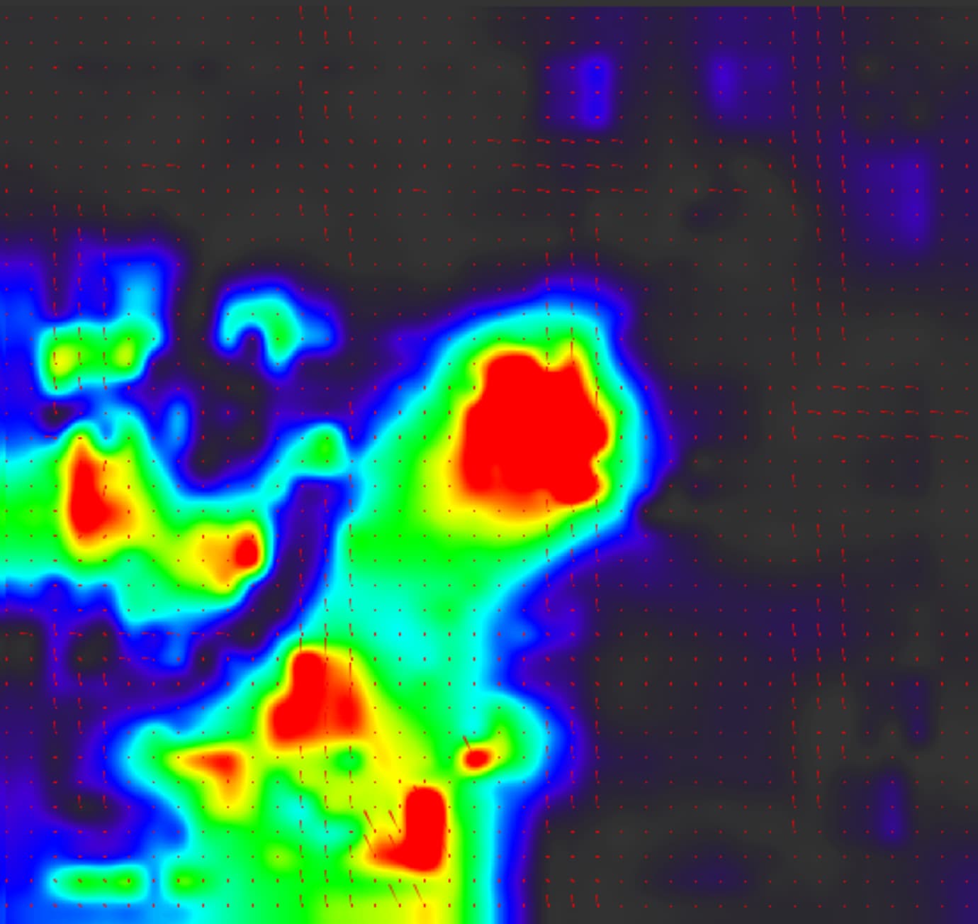
I was able to produce a velocity map at the end. However, the vectors appear to not flow in the correct direction or magnitude of the glacier’s terminus. It just looks like a repeating pattern of vectors. The color intensity of the velocity looks correct, with the faster red colors towards the calving front of the glacier. I have attached screenshots below. Maybe these vectors are correct – or maybe the parameters aren’t sensitive enough to detect changes in surface velocity?
Please let me know if there’s anything I can do to fix this problem and let me know if I need to send in any other information on this project. Thanks in advance.