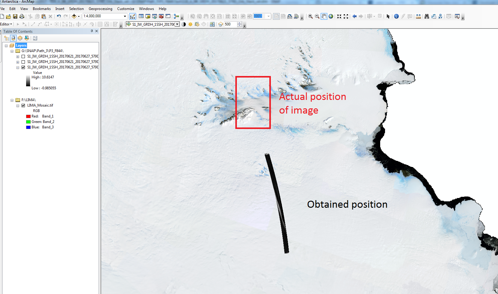
The results obtained from the offset tracking using Sentinel-1 in SNAP were good except when I exported it in GeoTIFF/GeoTIFF+XML/GeoTIFF+BigTIFF format to open in ArcMap, the images were displaced from the actyual position. I tried changing the projection systems but it also didn’t work for me. Could you please guide me for exporting the BEAM-DIMAP to GeoTIFF format? I also tried calculating the velocity directly in GeoTIFF format but the results were same.
Also, are the velocity in m/day or is between the displacement between two time period of acquisition?
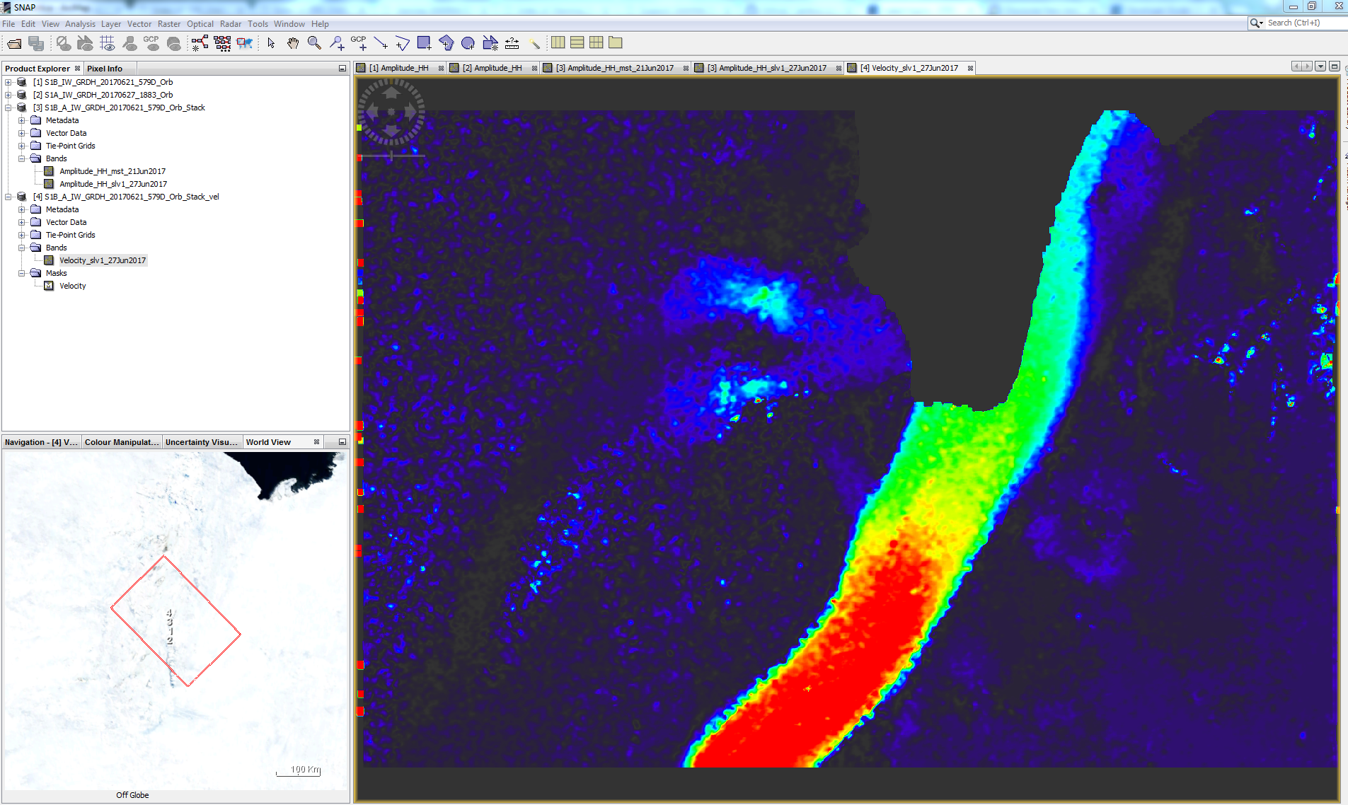
I’ve attached the results of SNAP as well as ArcMap.
No I didn’t terrain correct the image previously. I terrain corrected it now but the size of the image is exceeding 4 GB and it is not being converted into GeoTIFF. Is there any other method that could be used for exporting the BEAM-DIMAP results into GeoTIFF format?
you can leave the BEAM-DIMAP format as output for the RD Terrain Correction and directly open the img files in the .data folder into your GIS.
May I ask where your data is located and which scenes you used? This is a nice example for the Offset Tracking tool and I would like to repeat it with my students if you agree.
It looks like the ice-stream(s) feeding the Amery ice shelf in East Antarctica. Antarctica should be a good case since there is practically no surface melting and the ice stream are big.