I want to know if this method is useful only for analyzing glacier velocity or can it be useful for landslide analysis also. As i am getting weird results for the final answer when using it for landslide analysis.
The offset tracking module is basically searching for matching patterns in both images within a small given area. If glaciers are covered by stones or other gravel, these patterns are preserved, even if the glacier is moving.
For landslides, surface patterns often completely change (trees break, surfaces are overturned or tilted) so the matching algorithm has no chance to find suitable pixel pairs.
I would say it works if the landslide moved a large part (several hundred meters, as S1 has only 10m pixels) which didn’t change at its surface.
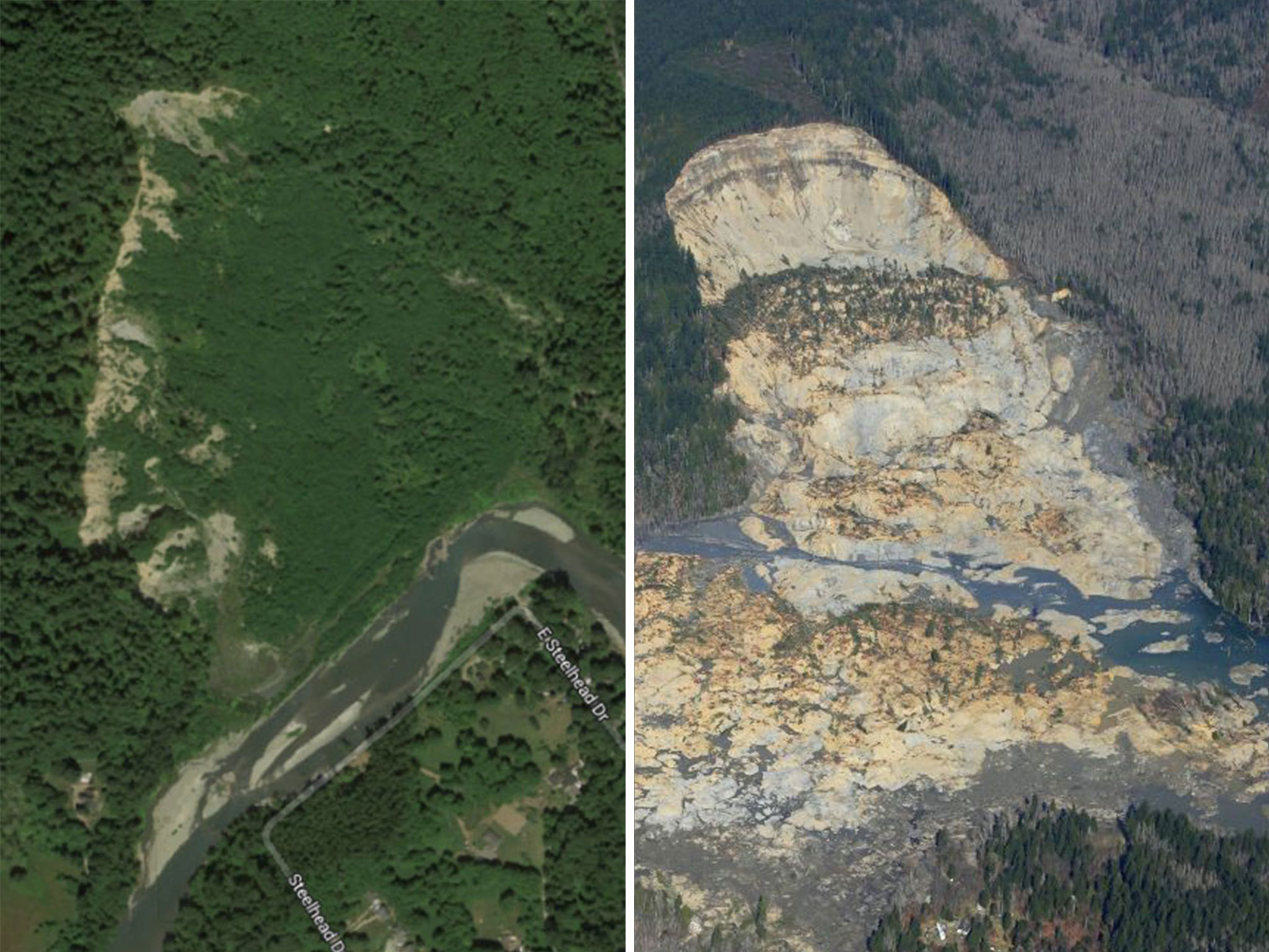
If it is a landslide like shown below, you don’t have any chance.
i am trying to use S1 data for landslide application.Is there any module or procedure by which i can detect change over a period of time or some thing similar in snap. i did perform DInSAR to get displacement but was wondering if something similar to what i am looking for exists or should i try to perform PSInSAR
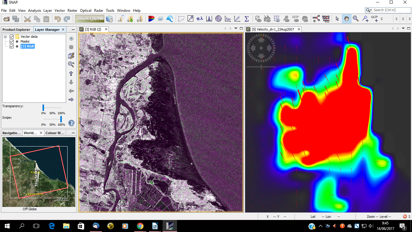
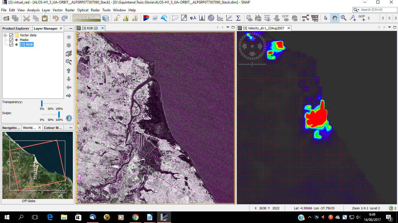
I found that SNAP can do offset tracking but the result may not right. The result of glacier moving, for example, will be better, but like landslide or debris flow the result may wrong. I have done some tests by using SNAP offset tracking and GAMMA. SNAP would detect some large movement areas, but GAMMA return none at the same areas. I doubt it is the different algorithms between SNAP and GAMMA, and I’m inclined to GAMMA’s.
Hi YuL, did you compare glacier velocity derived from SNAP and GAMMA ? Did you see major differences ? Please share your experience.
Thanks in advance.
Yes I did it. Unfortunately the data in my hard disk have been destroyed by an accident, so I cant show you. As I remember the glacier velocities both in SNAP and GAMMA results distributed in the same area at least. And the values of velocities were close. But the results for landslide were very different and very odd.
Agree to the researcher in Brazil, she says that results are not feasible, the results of offset tracking are in meters, and her says me that this are in cm, the dune no move 3 m for those period of test!!!
Hello sir! Could you please share your experience about GAMMA offset tracking processing?
I am studying an explosion case that is somehow like the landslides. I am highly agree with you that SNAP may do offset tracking well on glacier cases but not reliable on other cases, even it can cause mistake.
I have processed D-InSAR with GAMMA, but I know little about its offset tracking function. It is lucky to find your information here and I really hope you could give me some suggestions. My questions are:
1-What is the exact command to perform offset tracking? Which module dose this command locate, ISP or MSP or DIFF?
2-How to get the result visualized as displacement maps on azimuth and range respectively?
I have processed SBAS-InSAR with GAMMA using ENVISAT ASAR data to study land subsidence.
The commands I used were :base_calc, multi_look, raspwr, mk_geo, SLC_resamp_all, mk_mli_all, mk_diff_2d, mk_adf_2d, mk_unw_2d … then I set values of spatial and temporal baseline so that I got a file “header.txt”. And then I run “sbas header.txt” in my teminal.
For results visualization, I used GMT software.
For offset tracking, I am a beginner.
Could you offer me some GAMMA related tutorials or the websites (like forums)? Especially about offset tracking, thanks in advance!
Sorry to reply you so late. You can find all the detail of offset-tracking in ISP/html/ISP_users_guide.pdf. The example is at page75 in this pdf. Hope can help!

