As part of my thesis I need to reference the way in which the images I used were atmospherically corrected, but since I worked using L2A products, I never needed to apply atmospheric correction myself.
I am aware that L1C products can be corrected using Sen2Cor, among other methods, but I can’t seem to find about how and when L2A products undergo atmospheric correction ? Does the Sentinel-2 system itself apply such a correction when creating the image ? Is it done as the image is saved in the database ? The atmospheric correction method used is the same as Sen2Cor’s ?
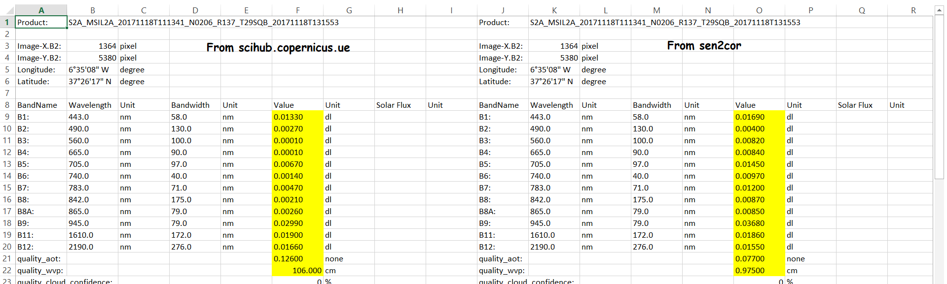
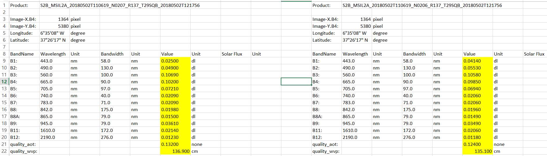
I have a similar doubt. I am analyzing some 2017-2018 images. If I take 1C and 2A images from same date and process the second one with sen2cor i have different values.
So, what is the treatment that use in scihub?
Hello
Sentinel-2 Level-2A (L2A) products do undergo atmospheric correction, but this correction is applied by the European Space Agency (ESA) as part of the processing chain before the products are made available to users. The atmospheric correction applied to Sentinel-2 L2A products is indeed similar to Sen2Cor, which is a widely used atmospheric correction tool specifically designed for Sentinel-2 data.
Here’s how the atmospheric correction process for Sentinel-2 L2A products typically works:
Data Acquisition: Sentinel-2 satellites capture data, including information in multiple spectral bands, during their orbits.
Initial Processing (Level-1C): The raw data from the satellites are processed to create Level-1C (L1C) products. L1C products include radiometrically corrected data, geometrically corrected data, and information on the satellite and sun angles.
Atmospheric Correction (Level-2A): After the generation of L1C products, the data undergo further processing to create L2A products. This processing step includes the atmospheric correction. Sen2Cor is one of the tools used for this purpose, and it applies a correction to remove the effects of the Earth’s atmosphere from the imagery. This correction is essential for accurately quantifying surface reflectance values.
Generation of L2A Products: Once the atmospheric correction is applied, the data are organized into L2A products, which include surface reflectance values for various spectral bands. These products are then made available to users through data distribution channels like the Copernicus Open Access Hub.
User Access: Researchers and users can access the L2A products, which already contain atmospherically corrected data suitable for various remote sensing applications, including land cover classification, environmental monitoring, and more.