I think GPT is a processing tool focused on batch processing where there may not be a graphics screen. The are many tools that can be used to view images created with GPT. I generally use tools that support geolocation. In addition to SNAP, there is NASA Panoply. IDL, Matlab, Python, R, etc have packages that support viewing geolocation images.
In order to create RGB images you can use pconvert. This is also a command line provided by SNAP.
Type pconvert -h or check the pconvert page in the help
Yes of course. I am looking for the command to CREATE the image (basically a GPT command that substitutes “Right click → Open RGB Image Window → Select RGB-Image Channels”). Then I will visualize it with other tools.
Thank you, it seems to be what I am looking for.
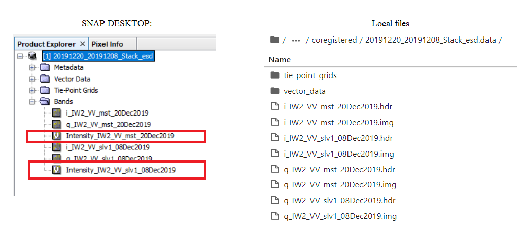
However the problem now is that the “Intensity_IW2_VV_…” file needed to create the .PNG image does not appear locally in the .data folder and so I cannot use it as input band in the -pconvert command. But when I inspect the product from SNAP Desktop, I can see it.
The band should be usable by pconvert. The band is ‘virtual’ and calculated on demand. As pconvert uses the product it has access also to the virtual band.