Greetings, I am trying to perform RUS Webinar: Earthquake deformation with Sentinel-1 - HAZA05. Unfortunately, at the later steps in geocoding, i get an error
I am not sure what I did wrong as i followed the instructions carefully. please and thank you
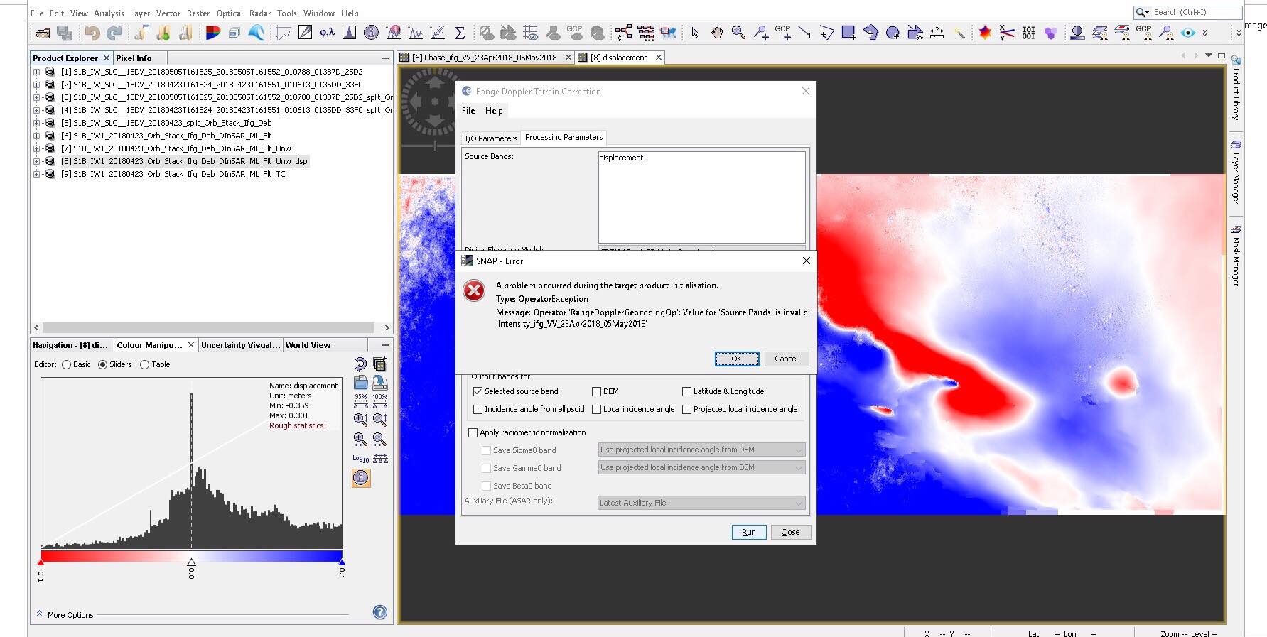
your result only contains the raster “displacement”. The operator somehow expects a band containing “intensity”. Did you apply a graph or something?
Normally, if you simply open the Terrain Correction and select the desired input product, this should not occur.