Opportunity for scientific use of PAZ data

Just for information for anyone interested in making application for scientific use of PAZ SAR data (the third satellite of TerraSAR-X constellation - https://directory.eoportal.org/web/eoportal/satellite-missions/p/paz).

One could apply here - http://www.inta.es/WEB/paz-ciencia/en/announcement-of-opportunity/

4 Likes

I received the first delivery today and just wanted to share some first impressions.
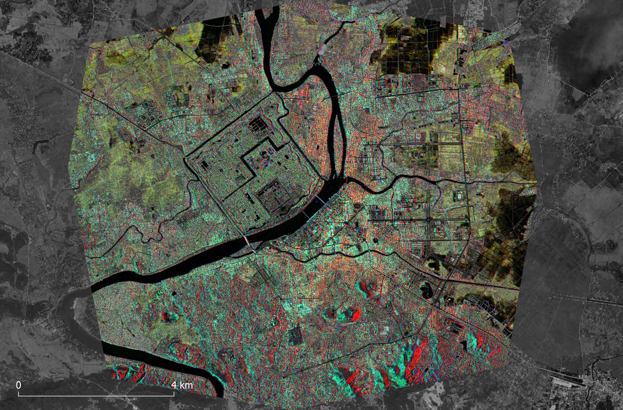
Three SpotLight images of the city of Hue, Vietnam
red = 20191008 descending, small incidence angle
green = 20191009 ascending, small incidence angle
blue = 20191014 ascending, large incidence angle

6 Likes

Impressive Andreas, thanks!

thank you. The data quality is great, as expected, as it is almost identical to TerraSAR-X SL data.
I was granted 24 products both ascending/descending and small/large incidence angles and try to find out which configurations (and threir combinations) are the most valuable for the mapping of buildings and urban flooding.

This is the coherence [0 - 0.75] in ascending (top) and descending (bottom) direction, both at around 25° incidence angle. As soon as I get more images, I will be able to analyze how the incidence angle affects backscatter and coherence of the urban area.

Are the products in SLC format?

yes, single look complex, HH polarization

What consistency values ​​(Coherence) are optimal for applying a deformation or subsistence with SAR SENTINEL 1

there is no absolute limit (the higher the better), but besides high coherence, what is more important is the availabiliy of good coherence over wide areas, and not just single patches), because this is needed for the later unwrapping.
But I think this discussion does not belong in here.

@Oliverius I suppose 0.4 for coherence could be fine. You can also experiment with BandMath setting different values for coherence masking the unwrapped image.

I’d like continue here, although it might not necessarily be related to PAZ data alone.

I have 24 images and calculated coherence between all possible combinations. Most of them look fine and the temporal baseline obviously affects the coherence patterns (stable over urban areas, rapidly decreasing over natural areas)


grafik

However, all pairs related with one particular date have strong errors in the coherence, either expressed by systematic stripes or even no coherence except for a stripe in the center of the image


I don’t know how I can cope with this. I tried to increase the number of CGPs for the coregistration and also removed the topographic phase during coherence estimation, but the results were largely the same.

Does anyone have an Idea how I can deal with this faulty date? Its backcsatter intensity looks alright.

You should contact the satellite operators to see if there is something non-nominal with that particular acquisition.

yes, I’ll probably do that, thank you.

I managed to get it slightly better by changing to bilinear interpolation and increasing the row interpolation degree, but there’s obviously a systematic error to this scene.

It’s a shame. The link is broken. :cry:

yes, the announcement has ended over one year ago.

Just to update the info in this thread.
In the following link you can check the current Announcement of Opportunity to access to PAZ products for scientific use: PAZ science current Announcement of Opportunity

1 Like