Dear ABraun,
Thank you very much for answering my question. Do you know of an optimal page for precise and restituted orbits?
Thanks for the reply,
Best regards
Dear ABraun,
Thank you very much for answering my question. Do you know of an optimal page for precise and restituted orbits?
Thanks for the reply,
Best regards
For earthquakes, we use the early restituted orbits (RESORB) for InSAR processing. They work well in every case I have seen. The SLC products are usually processed by ESA when the RESORB is available.
Dear ABraun
Thank you very much for your response and the information on the website.
Best regards
Dear Eric,
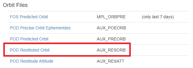
RESORB, is it on the same page that ABraun previously indicated? If yes, is “POD Restituted Orbit” selected in the Orbit File list?
And just one more question for you. How do you do it, for example, when there is an earthquake today with the accurate estimation of an orbit for Sentinel? because it would be expected that for earthquake studies, they are as fast as possible to see their impact. Or otherwise, just wait the approximate 20 days to have precise orbits?
Thanks in advance for your reply,
Best regards
Yes, we call it RESORB because that is in the filename, but the full name is the POD restituted orbit.
We make urgent response products for earthquakes as soon as we can get the Sentinel-1 SLC images and RESORB files. Rapid products are helpful for responding agencies to know where damage is worst. Displacement maps show how much the land has moved, which can affect roads, pipelines, bridges, flooding, and many other things, so we try to get the information out as fast as possible. Speed is more important than the most accurate maps.
Scientific studies have a slower timeline, so some people wait for the final precise orbits (called POEORB). In most cases, the errors from atmospheric effects are much larger than the difference between the two orbits.
Thank you very much for your reply Eric. I would like to have the opportunity to ask you two more questions.
Satellites like Tsx, Csk or Alos or even Nisar have orbits included when acquiring them? so they don’t require accurate orbit estimates?
Should ionospheric correction always be performed in all InSAR studies? One of the methods I saw that they use a lot is the split spectrum method. These types of corrections should also be made to images, eg GRD and OCN?
Thank you very much for your reply,
Best regards
Modern satellites, including TSX, CSK, ALOS-2, Sentinel-1, and NISAR, have GPS or GNSS receivers onboard to measure the orbits, in addition to other tracking systems. The GNSS data is downlinked with the radar data, but it needs to be processed to calculate precise orbits. The GNSS processing centers have to estimate the precise orbits of the GNSS satellites, which takes some time. We can’t calculate the precise orbits of the SAR satellites until we have the precise orbits of the GNSS satellites.
There is no need for ionospheric corrections of OCN data, and I never heard of any corrections for GRD either.
Ionospheric corrections are highly recommended for InSAR studies with L-band SAR data, such as ALOS, ALOS-2, SAOCOM, and NISAR because the effects are stronger than for the shorter wavelengths.
Ionospheric corrections are recommended for ascending and descending Sentinel-1 InSAR in the tropics and high latitudes, and may help for ascending tracks in middle latitudes. You can see our published paper on ionospheric correction of Sentinel-1 InSAR for more details.
Liang, C., P. Agram, M. Simons, and E. J. Fielding (2019), Ionospheric Correction of InSAR Time Series Analysis of C-band Sentinel-1 TOPS Data, IEEE Transactions on Geoscience and Remote Sensing , 57 (9), 6755-6773, doi:10.1109/TGRS.2019.2908494.
https://ieeexplore.ieee.org/document/8706258?source=authoralert
For those who don’t have access to IEEE TGRS, we posted a preprint of the first submitted version on EarthArXiv:
https://eartharxiv.org/atxr7/
The final published version is only slightly modified to address reviewers’ comments.
Dear Eric,
Thank you very much for answering my questions and Sorry in advance if I ask another question, but it is a very very interesting topic, like the publication that you participated. I use SNAP and GMTSAR and GMTSAR uses range split-spectrum method in its ionospheric corrections. You at JPL use this same method with ISCE (for example, in you paper)? or ISCE provides more alternatives?.
On the other hand, do you use any particular method with ISCE to make tropospheric corrections?
I thank you very much for the answer,
Best regards
Yes, ISCE uses the split-spectrum method for ionospheric corrections of Sentinel-1, as described in the Liang et al. (2019) paper. I believe that the GMTSAR developers implemented the same method after looking at the ISCE code. Note there are two types of ionospheric corrections, the range correction to the phase and the correction for the along-track shift, which also causes a phase change in TOPS data. I know the ISCE code does both corrections. I don’t know about GMTSAR.
ISCE does not include any tropospheric corrections, so you have to use another package. I have used PyAPS, TRAIN, and MintPy to do atmospheric corrections.
I agree with @EJFielding . I have even seen once a presentation (from DLR) showing that using the Restitute orbits you get precise information in interferometric products with small differences wrt to Precise
Is this presentation available somewhere?
Sounds interesting
I have tried to find it online…and I could some time back. I will ask the author and di will let you know
Thank you very much for reply Dr. Fielding!
Hello everyone,
I have a new question that confuses me. I would greatly appreciate it if you can help me.
What is the difference between using these two sources of orbits? Is there one better than the other?
https://qc.sentinel1.eo.esa.int/ (I have used this in response to this forum)
https://s1qc.asf.alaska.edu/aux_poeorb
Thanks for any help,
Best regards
I believe that the ASF (asf.alaska.edu) archive of orbits is a mirror of the ESA archive, like the the ASF archive of data products is a mirror of the Copernicus SciHub archive. They should be the same, but the ASF mirror is usually a day or two behind due to the transfer time, especially for the large data files.
Thank you very much Eric for your reply.
Please, one more question for you or someone else that could guide me.
In the InSAR study application, is there a real difference in using AUX_RESORB or AUX_POEORB? Correct me if I’m wrong. The AUX_RESORB for studies with more recent day orbits (for example, before 20 days) and the AUX_POEORB (POD Precise Orbit Ephemerides) for studies greater than 20 days. But are they both very accurate in orbit?
What happens is that I want to try on my own, use these orbits by loading them manually, for subsidence studies from 2017 to April 2020. So, for studies from before April 2020, will I be able to safely use the AUX_POEORB, will I get an accurate result?
Excuse the length of my question and thank you very much.
In my experience, the Sentinel-1 RESORB orbits are extremely close to the final POEORB orbits. It is possible that there could be some variations due to satellite maneuvers or other effects that are better corrected in the POEORB files, but I have not seen this.
I didn’t find what kind of orbit data is used inside the GRD products.
Does GRD-Fast24h contain RESORB orbit data ? If yes, I guess there is no impact to apply orbit correction with RESORB orbit file on GRD product…
The used orbits are specified in the metadata. I’m not sure what the current baseline for GRD-Fast24h is, perhaps @ghajduch could help?