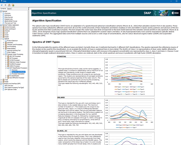
I am using OWT classification to define different water types for coastal water. The output is a raster map with numbered classes. What does each water type number means ? where can I find the description of each class ? Is it possible to group the water type classes in turbidity categories, like clean, moderate and turbid waters ?
The classes depend on the OWT type you select as parameter.
The types and classes are described in the help.
More about the algorithm can be found here: Remote Sensing | Free Full-Text | An Optical Classification Tool for Global Lake Waters (mdpi.com)
About the GLaSS classes you can read more here: GLaSS Deliverable 3.3 2014 - Optical pre-classification method (the current link in the help is not working anymore)
Hello Marpet and other users,
I am searching for some information about the OWT classifier loaded in SNAP. I read the document (Algorithm Specification) and the references listed below.
But I only found the description of ‘INLAND’, ‘GLASS_5C’, ‘GLASS_6C’ and ‘GLASS_6CN’, not include ‘COASTAL’ (the wavelength required and the number of class are inconsistent with Moore et al. (2014)).
So I want to ask that is there any other information or references about the parameter ‘COASTAL’, where does the in situ data come from and so on?
I’m sorry we haven’t found the origin of the COASTAL type anymore.
I suggest that you contact Marieke Eleveld. She is the author of the GLASS paper. She might know more about it.
