Hi there,
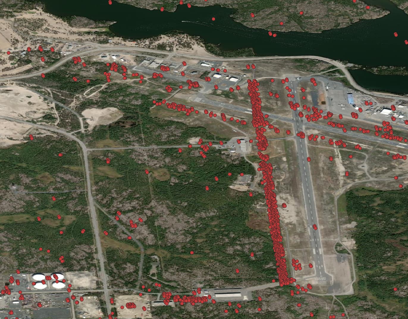
When producing a Persistent Scatterer result for Northern areas (specifically Yellowknife in this case). There appears to be an offset between the location of the PS points and the surfaces in the basemap.
As you can see the points the would be scattering over the runway appear to have a ~200m offset. This trend was confirmed using a Sentinel-2 image aswell. The DEM input was the Copernicus 30m DEM.
The geometric accuracy of SAR is excellent and certainly much better than S-2. Something must have gone wrong at the map projection step of either your S-1 stack or the reference S-2 image. Are you using S-1 data?
Yes the data used in S1. The same processing chain has been used for many PS runs. This error only seems to occur in Northern Regions. This error was reproduced with the ASTER Dem in Northern Regions as well. It has been compared to multiple basemap images included S2.
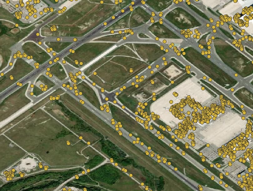
Below is a screenshot of the same processing parameters overtop of Toronto Pearson Airport. Where no offset is occurring.
The relative position of a scatterer within a resolution cell causes an additional phase contribution in the observed phase, which needs to be accounted for in PSI processing. Please see this reference.