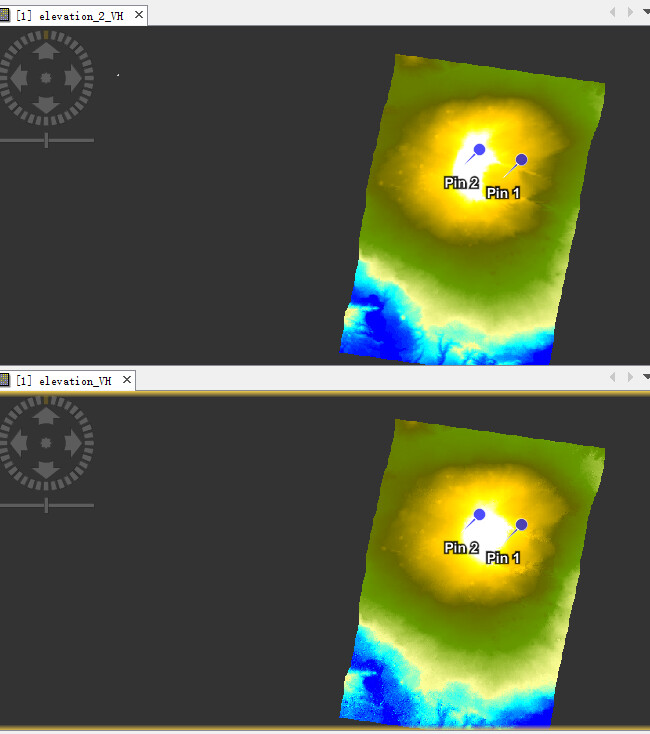
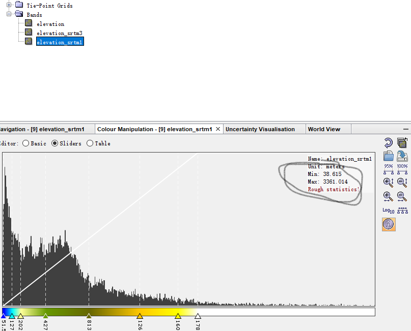
Hello everyone! This is the result of ‘Phase to Elevation’ and SRTM DEM (Add Elevation Band)
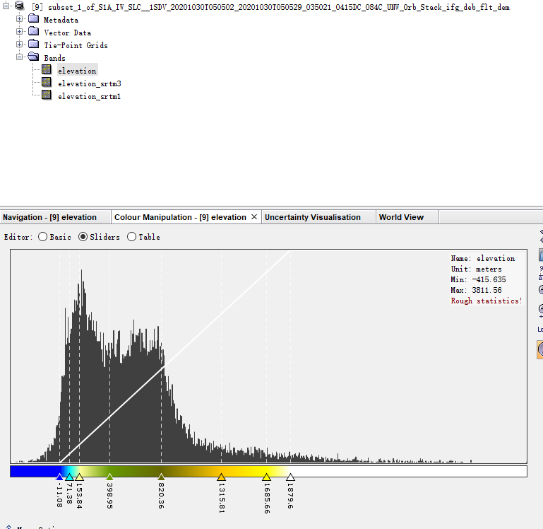


But why is there so much difference between the maximum and minimum of the two?
Hello everyone! This is the result of ‘Phase to Elevation’ and SRTM DEM (Add Elevation Band)
InSAR is very sensitive to errors, and especially the unwrapping process can produe extreme outliers. It is not really a measure of similarity to compare the min/max values.
I suggest to create a difference image (elevation - strm1) to see where these errors occur and also how they are statistically distributed (histogram of the difference)
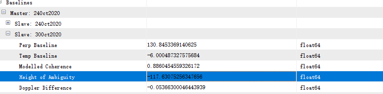
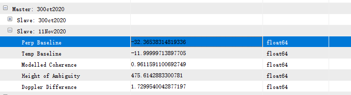
What is your perpendicular baseline by the way?
This is the perpendicular baseline.
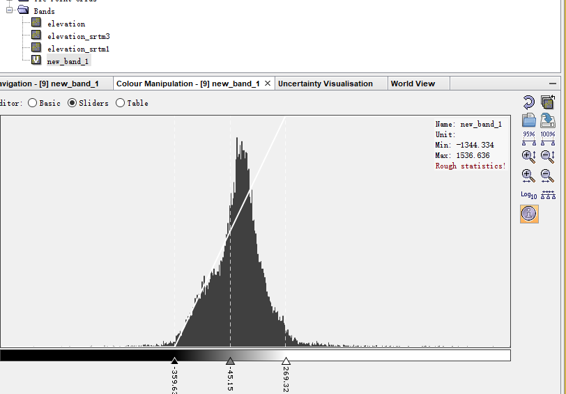
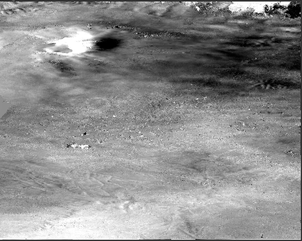
The below figure is : elevation - elevation_srtm1. It seems that the difference is too big.
32 m is quite short. As you see, the height ambiguity is 475 meters, which means that each fringe (color phase cycle) represents 475 meters of altitude difference.
If you find a pair with a perpendicular baseline > 100 meters the height ambiguity is reduced to a lower value, thus potentially revealing more variations and details (and there fore less errors at slopes).
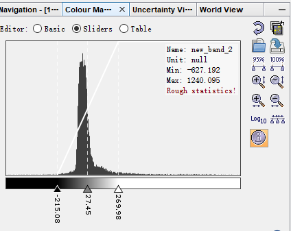
Thank you for your suggestion. According to your suggestion, I re-selected two sets of data, and the results are as follows:
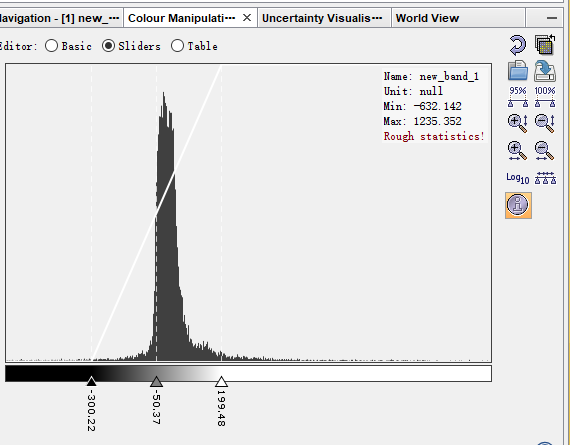
I feel that this difference is still a bit large, is it caused by no terrain correction?
as the histogram shows, the errors are now largely beween +50 and - 50 m. So this range has clearly been reduced by selecting an image pair with larger perpendicular baseline. In your first example, the errors roughly ranged between +300 and -300 m.
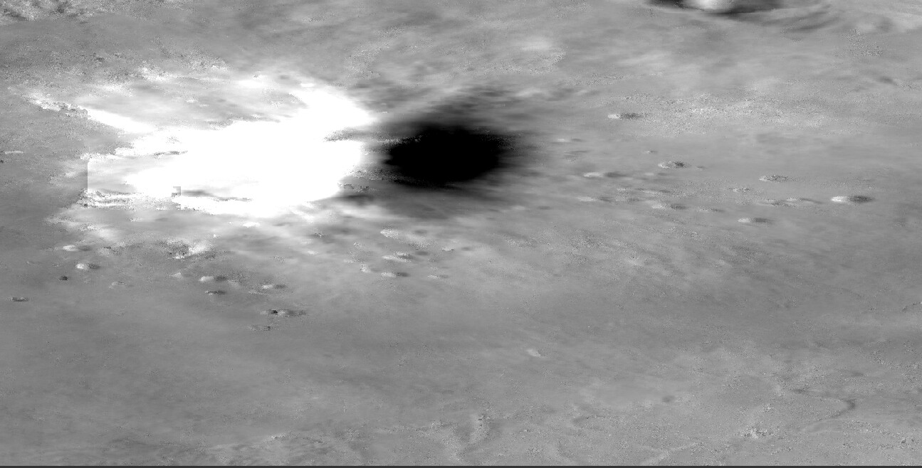
The difference image also shows that the largest errors result from the look direction of the sensor: pixels facing away from the sensor are strongly underestimated and pixels facing towards the sensor are overestimated. There’s not much you can do about this, because the side-looking geometry will always have shadow areas for such extreme landforms.
Maybe it is worth comparing DEMs generated from both ascending and descending orbits (or even to combine them).
Thank you for your suggestion. In addition to the influence of shadows, due to foreshortening, the top of the volcano will be biased toward the line of sight, and there will be some errors in the generated DEM and SRTM, so should I compare it after terrain correction? This is the result after I performed terrain correction, but it doesn’t look much different from before.
no, all data is correctly processed in slant geometry. Terrain correction only moves the pixels to their correct location, but the InSAR information already considers all this before.