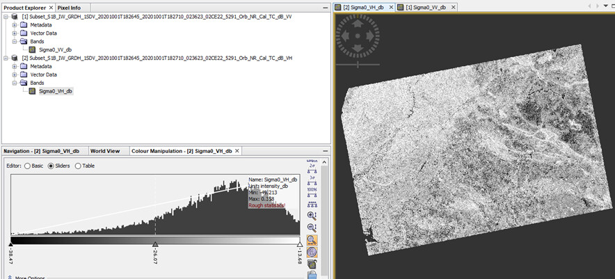
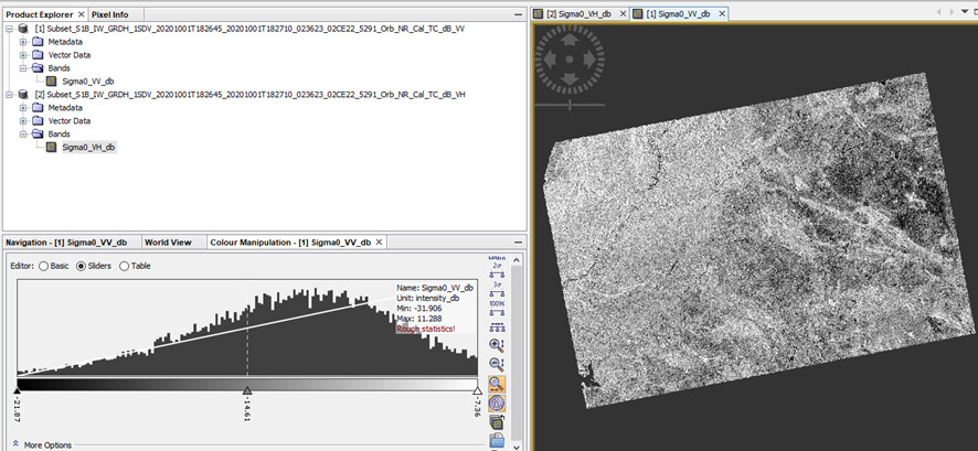
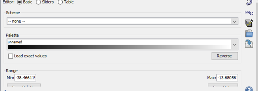
I have a question concerning the pixel values. In the workflow I convert linear to db, are these range of values normal for these images (first VH, second VV) or should make some other conversion? And is there a quick way to tell the difference between a VH image and VV image?
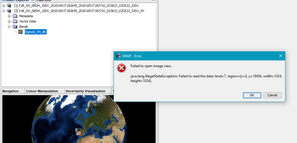
I have posted another topic with this exact same question, I can´t open these geotiffs in snap. Could it have something to do with this?
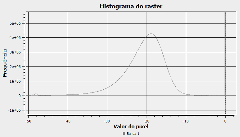
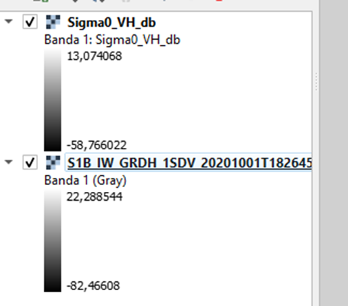
The db pixel values are supposed to have negative values? I was checking in Qgis and they seem to be negative, couldn´t find any positive.
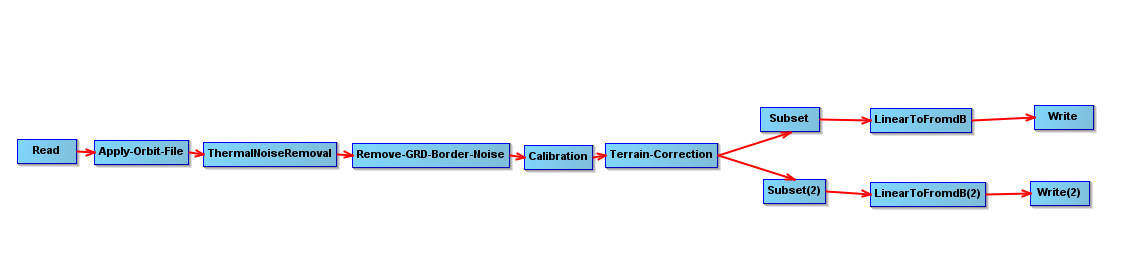
In SNAP you should work with the satellite products and not directly with the geotiff data layers inside them. Export to the format you need afterwards.
I just check with the histogram in Qgis and it seems to look fine, I think.
Could this mean it´s only a matter of adjusting the range of values? In Snap should be a lot easier to see this but can´t open, as mentioned before.
Open the output products of your processing-chain in SNAP and see if the values are correct there. Then export to GeoTIFF. You cannot assume the geotiff-files inside the products are fine to use as is.
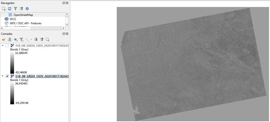
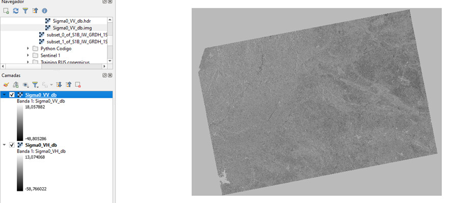
They are the exact same image. Then when I convert to geotiff and open it in QGIS again a different set of values. (below, image with first file being the same file opened in QGIS, and the second a geotiff created from the same image).
Randomly I checked some pixels and they all have the same value, it seems the process is correct. Didn´t see any strange values. Could this mean that the pixel values are correct, the images were correctly generated? Or do I have to make some other verification?