Thanks so much for all the tutorials and also for the xml template @marpet
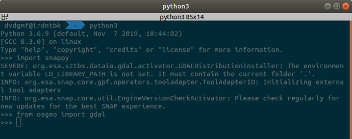
through some trial and error I’ve managed to get snappy up and running system-wide alongside GDAL:
Ps. I’ve also had this SEVERE message in the console but after some searching I saw this guy saying it was ok:
So…
Is there a way of making the gpt/gpf or snappy to simulate this behavior of the GUI?:
I did it in SNAP Desktop GUI and got this file: S3A_OL_2_WFR____20190309T141223_20190309T141523_20190310T211622_0179_042_167_3060_MAR_O_NT_002_manacapuru_Mask.txt (3.1 MB)
And I didn’t tested it to see where the lon/lat pixel data will fall on a map, was planning on doing it later today, but… My real question is: does that mean that the pixels that I extracted this way in the above file are actually everything inside the bounding box rectangle of the shapefile or only the ones actually inside the shapefile?
Sorry to keep bothering you guys with this, you already did such a great job by making all these great tools and data freely available to us.
Thanks again and keep safe! ![]()
![]()
David
