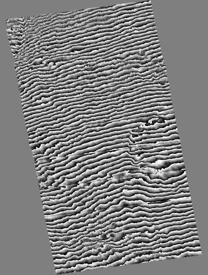
I am processing some S1B data with SNAP and I am getting very poor results as I have never seen before. I was getting the error WARNING: org.jlinda.core.Baseline: Max. error bperp modeling at 3D datapoints: 181.29944441074574m which was resulting in the complete decorrelation of my images. I was able to fix this error by changing the orbit degree to 4 instead of 3. But, fixing this yields in an image of just many fringes all going in the same direction which makes no sense, as well as what seem to be deburst artifacts.
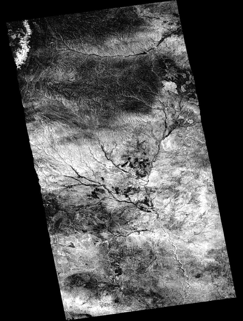
My basic processing involves applying the orbit file, topsar split, back geocoding, ESD, make interferogram, debursting, merge swaths, topo phase removal, multilook, Goldstein phase filter, snaphu unwrapping, phase 2 displacement and finally terrain correction. But I image this error is showing up before the deburst step as the images I have posted are of the coherence and the wrapped ifg.
Any help would be appreciated because I can’t seem to figure out what is going wrong with these ifgs.
This also isn’t the only case. Of the like 10 pairs I did with this 2017 S1B data, I either get the total decorrelation or many of these repeated fringes with like half. I also tested 2020 S1B data and this wasn’t an issue.
Would using a different DEM than SRTM 1 sec hgt possibly help?
Yes, flat-earth estimation is included in the interferogram formation. The parameters used are an orbit degree of 4, srpPolynomialDegree of 5 and srpNumberPoints of 701. I have tried multiple values for the srp and it hasn’t changed anything.