my picture was to big to handle the classification in QGIS. Now I used supervised classification SNAP. As it is only an image from google earth, a postprocessing has to be made. My question is if SNAP has a proper postprocessing tool. I anyway am not sure if an image of this size (1.29 GB) can be postprocessed in an effective way.
My second question is if validation has something to do with postprocessing. I guess not, because validation shows only the accuracy.
What makes you sure that you need post-processing?
Postprocessing can be anything that improves the quality of your classification. If you want to remove single or isolated mis-classified pixels, you can appy the median filter (right-click > filter band). This however only works if your image is stored as integer (full numbers), because otherwise the median would result in decimal values which no longer represent a single class.
There are pools of water classified as buildings for example, there is apart of the picture which is not as shiny as the rest and they where has classified almost all as buildings and bare soil. Furthermore, unfortunately the water in the original picture is very dark so it is classified as high vergetation (dark green).
I see no other option than postprocessing at least the water. I hope it makes any sense now. I actually couldn’t use the satellite imagery because although the resolution is 3 m, when I zoom in I can’t see anything clearly and in consequence I can’t prepare the training for supervisied classification. Unsupervised didn’t bring good results.
How do I know that it was saved as integer?
In advance, thank you for any further information.
I see. If it is just the water class, you could use the elevation and slope as additional rasters and make queries in the band maths to change the values of specific locations.
For example:
IF elevation < 5 AND class == 4 THEN 1 ELSE class
This would give every pixel with an elevation of smaller 5 m which is currently 4 the class value 1.
You can import the elevation by right-clicking > Add elevation band. SNAP currently does not support the calculation of slope or aspect, but once you convert the elevation band (right click > convert band) and save the product, you can simply open the elevation img in the .data folder in any GIS, calculate the slope and import it back into SNAP.
May I ask why you use a screenshot of Google Earth for classification? These data are often compressed and only contain (often drastically altered) RGB values. Maybe there are better data sources for your case. Where is your study area?
What I worte about training data is the problem; that is why I used google maps. Maybe the image should have been better than 3 m resolution but I do not have access to that without paying (I am a student at university and entered planet scope with the Research&Education program)…
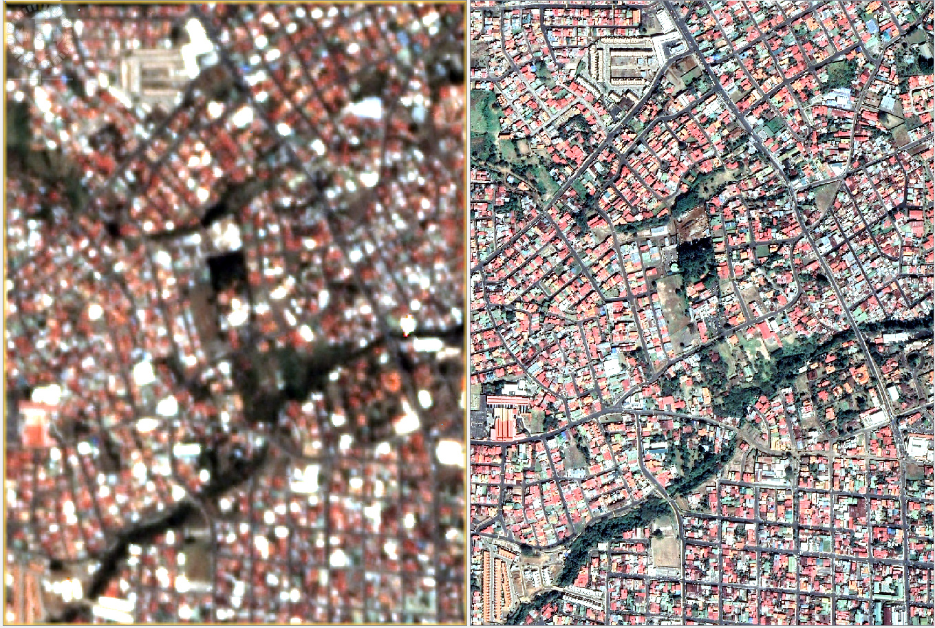
The pictures show google earth (right) and satellite imagery (left) to compare it and understand what I am saying,
so you want to extract single houses?
PlanetScope images have the advantage that you can calculate indices like the NDVI to extract vegetation (high values) and water (negative values) which is not possible with RGB, for example.
You could chose a combined approach to increase the quality of the classification based on the PlanetScope image, for example. Make a stack of both (with the resolution of the higher image) so you have 7 bands instead of three and way higher radiometric feature space. But make sure that both images are of same data type (Raster > Conversion > Convert Datatype).
For some areas, VHR imagery is freely available for educational purposes via ESA TPM. Where is your area located?
Thank you so much but I am running out of time and I think it must not be perfect for the purpose. It would be the best to have an almost perfect classification but as I said it is always something new that is missing…and I keep on not focusing on the actual task. It would be definitely interesting to work on.