Perhaps I misunderstand something about L2A and L2B. I am new to Sentinel imagery.
I have downloaded the data from Remore Pixels (https://search.remotepixel.ca).
From here we can download both Landsat and Sentinel imagery. The advantage of this service is that we can download individual band files differently from Earth Explorer.
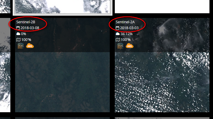
When you choose a scene, you will see several scenes for the location you choose with some labels on each one that refers to “Sentinel-2A” and “Sentinel-2B” - What is this Sentinel-B?
I thought “Sentinel-2B” refers to L2B Sentinel Scenes.
Also, for the Sentinel-2A tiles, they are named something like: S2A_tile_20180402_34LDR_0
In case of Sentinel-2B, they are named something like: S2B_tile_20180328_34LDR_0
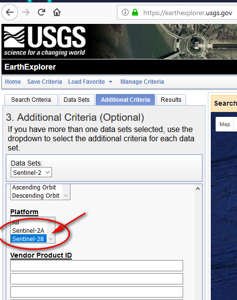
Even on Earth Explorer you can see under “Additional Criteria”, that you can select from Sentinel-A and Sentinel-B products.
SNAP and Sen2Cor should process both S2A and S2B (satellites/sensors). L1C (raw) and L2A (surface reflectance) are product levels.
You can also use this tool (https://github.com/kraftek/awsdownload/) or S3 Browser to connect with your AWS credentials to download from AWS. You can download from Google Earth Engine with their gsutil tool, but I haven’t tried. I find RemotePixel and EarthExplorer most easiest to use.
For pre-processing steps, i would think you’ll need to derive surface reflectance (with Sen2Cor), resampling all bands to single pixel size, derive vegetation and mineral indices or band ratios (https://www.indexdatabase.de/db/s-single.php?id=96) and then thresholding based on those, some image classification (unsupervised, supervised, spectral unmixing).
Hi envimatix,
Thank you for your asnwer.
Based on your comment, I need you to help me.
Based on my understanding, “resampling all band to single pixel size” can be achieved also by sen2cor is that correct?
On sen2cor, when we choose a band resolution on sen2cor, the final product bands will all be re-sampled to that resolution ?