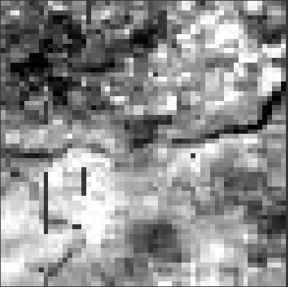
I should create subsets of MERIS L2 FR (4th reprocessing) products with all the same dimensions. To do this I used SNAP’s “collocation” operator after creating the master image. The problem is that in the images that have been generated there are some stripes that have a NaN value, as you can see from the following image:
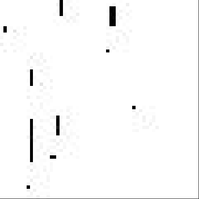
These points also appear in the “collocations_flag” band:
To create collocated images I used the following settings:
Geo-Location:
Use sub-pixel fraction axccuracy for pixel-based geo-coding
Use high precision approximations for inverse tie point geo-coding
S3TBX:
Read ENVISAT MERIS products in SAFE format with per-pixel geo-coding instead of using tie-points
Collocation operator:
Resample Method: Nearest Neighbour
The processing was done with SNAP version 9 and OS UBUNTU 18.04
I would like to point out that the problem does not happen if “sub-pixel fraction accuracy” or “per-pixel geo-coding instead of using tie-points” is not used, but in this case the geolocation of the points in the image is less accurate.
What could be causing the problem? Thanks to anyone who can give me suggestions.