Dear All,
I am currently attempting to mosaic multiple SAR scenes into a single layer which I can use for land-cover classification purposes.
I’ve followed the basic steps regarding preprocessing the images, having calibrated > speckle reduced > terrain corrected > convert linear to dB my images separately. These have all worked perfectly fine, and have produced images that is exactly as I want them.
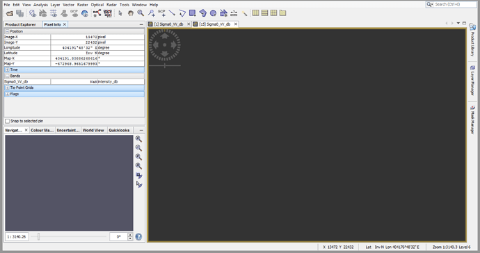
However, for my last step, as I used the SAR-Mosaic function to create a final image, I’m getting a completely blank image with very weird pixel info values:
The actual pixel numbers seem to be correct, but the longitude has become huge, latitude is invalid, and all throughout the image, I have either NaN or Inv for my band values.
I’m mosaicing 14 different scenes together, and I’ve tried doing them separately, with out without changing the result resolution, different resampling methods, or tried turning both ‘Weighted average of Overlap’ and ‘Normalize’ on or off. Regardless of what parameters I’m using, I seem to be getting the same problem in my output image.
Am I doing anything wrong?
Your help is much appreciated!
Calvin
