Hello, i’m working on ice detection algorithm for rivers using S-1 images, but later on, I also want to overlap these images with S-2 (probably in R). The problem is, i can’t seem to get a wanted resolution of 20x20m. currently i’m using this processing chain
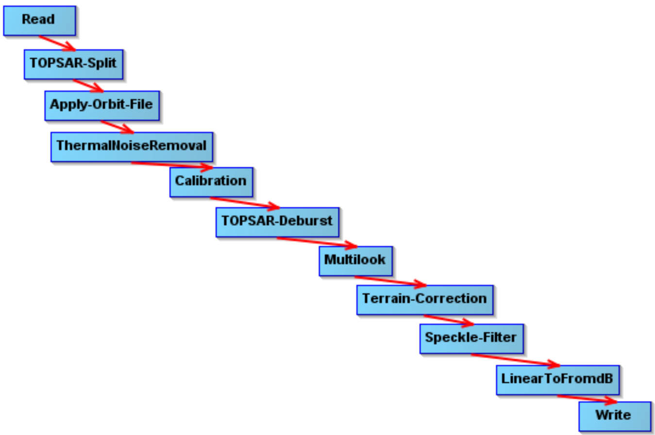
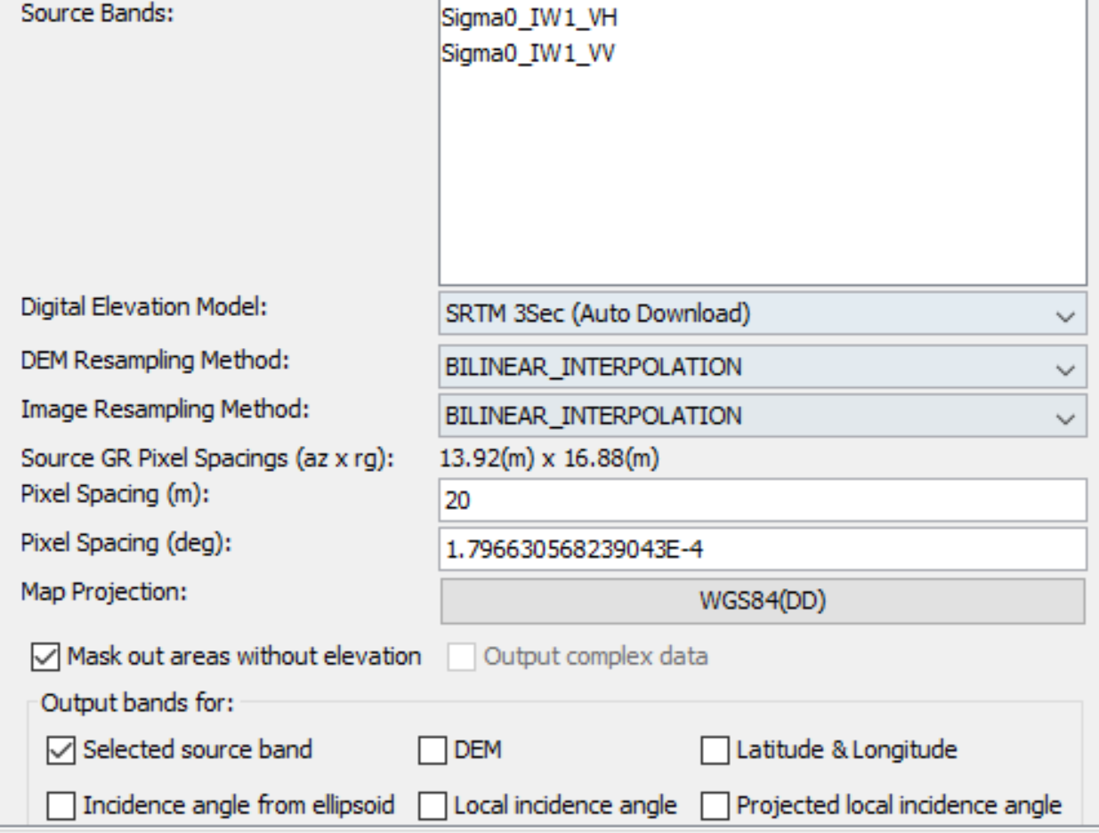
I multilook the images with these parameters

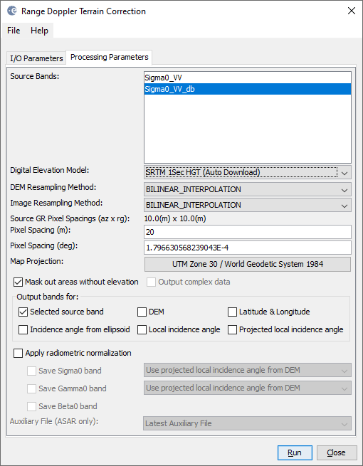
Ant then terrain correct them for pixel spacing of 20 meters
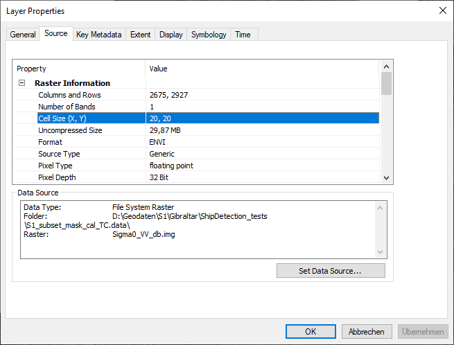
As I understand, the metadata suggest that i do have a desired resolution, but when i measure pixels with theruler tool or in ArcGIS, it suggests that the pixels aren’t even square. [image]
Any thoughts on what am i doing wrong?