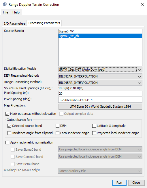
the pixels are squared after the terrain correction.
The 13.92 x 16.88 m refer to the data after multi-looking but before terrain correction (it says “soure ground range pixel spacings”). If you enter 20 m here, the output will be resampled accordingly.
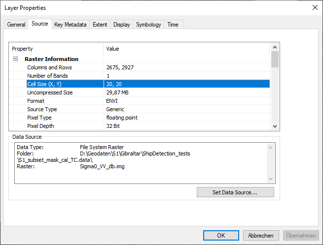
Instead of measuring pixel resolutions, please check the image’s information in the layer properties:
defining 20 m in SNAP:
resulting resolution in ArcMap: