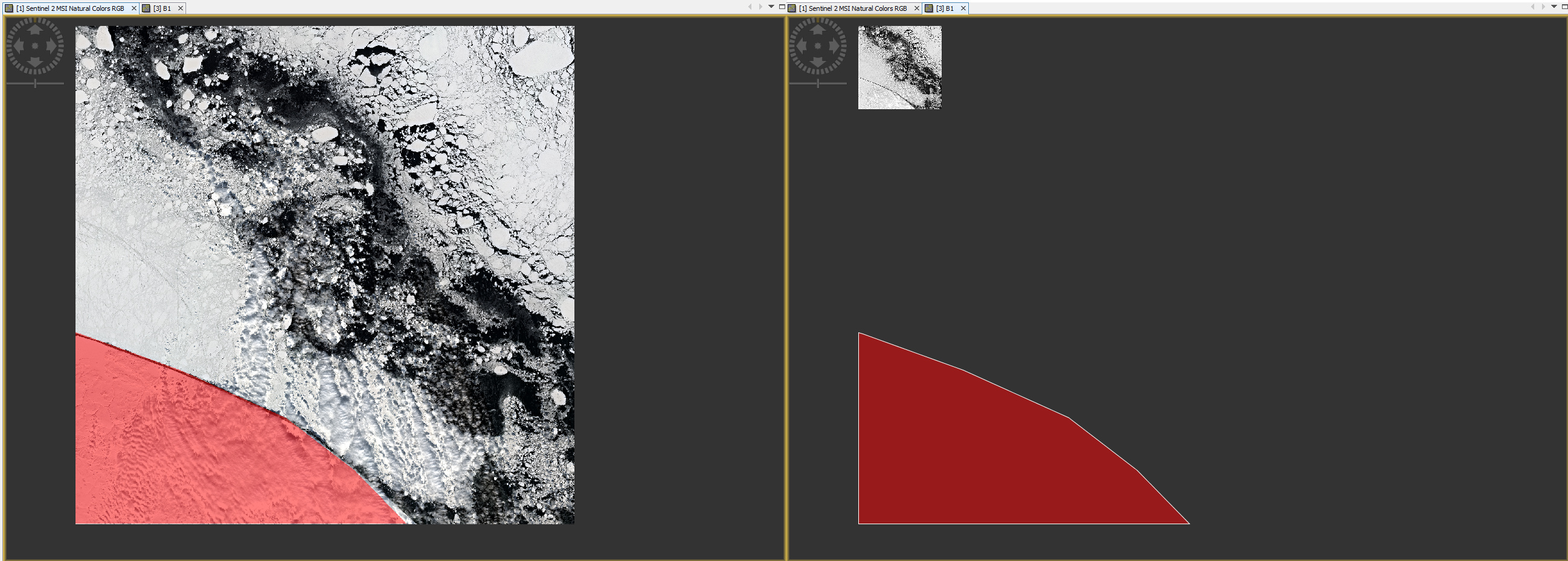
Dear all! I uploaded land mask as polygon, it is GSHHS polygon. I am trying to apply this as Land Mask (on the left of the picture). As a result I get the smaller version of image moved north. What am I doing wrong? Projection of the shore polygon is geographical, wgs 84. Thanks in advance for help!
as you are using Sentinel-2: Have you resampled your product to a common resolution? Original S2 data has bands with 10m, 20m and 60m, so this could be part of the problem.