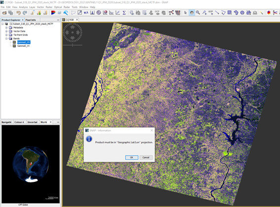
I did the Sentinel 1 image processing with the same track obtaining excellent visualization results. The processes that I carried out are the following: Thermal Noise Removal, Apply Orbit File, Remove GRD Border Noise, Slice Assembly, Subset, Radiometric Terrain flattening, Range-Doppler Terrain Correction, Create stack, and final Multitemporal Compositing. However, I cannot project the images to Google Earth despite being in Geographic Coordinates (Lat / Lon). When I do the reprojection it gives me the result that the product must be terrain corrected or ellipsoid corrected ???
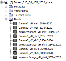
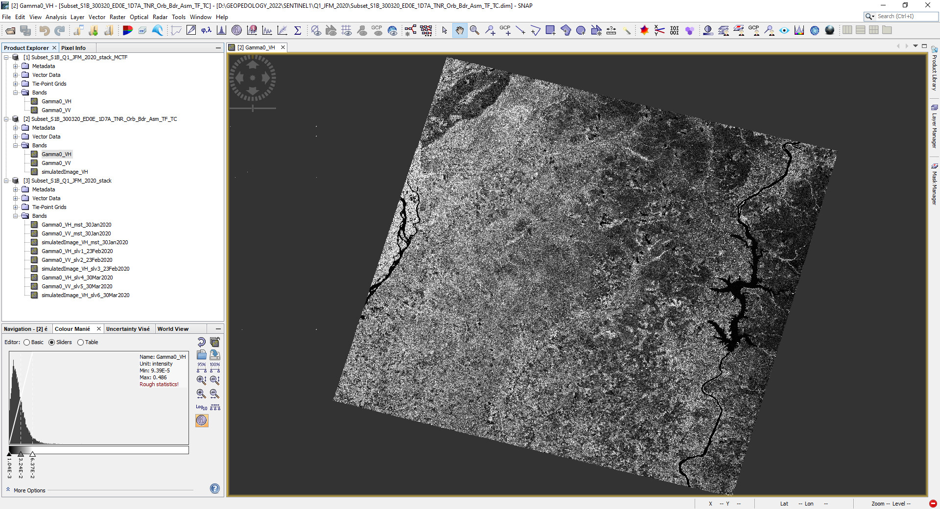
your screenshot shows two bands, why did you apply create stack?
Actually, if you selected WGS84 during terrain correction, reprojection shouldn’t be necessary.
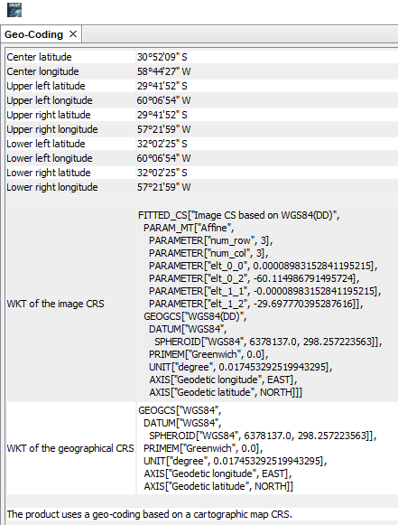
Can you please select your product and open the Geo-Coding window via the menu > Analysis > Geo-Coding?
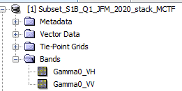
Thanks so much Andreas. After using the create stack I have an image with 9 bands of 3 different dates. When multitemporal composing the result is two bands.
Geocoding analysis is fine.
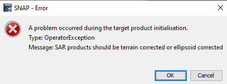
Now, if I consider the Terrain Correct when exporting as KMZ it gives me this error as well.
???
now I understand, thank you. But if the stack has the geocoding you just showed it should be directly usable as input for the KMZ export without any further steps. What do you get if you select this stack and then perform the export?
After doing the Terrain Correction the same problem is repeated. The end result of the multitemporal composition is fabulous, excellent, but I can’t export anything. I will try to make an integration of this product with the Sentinel-2 with the Collection algorithm and see what happens. But I’m frustrated because I processed multiple images in light of the excellent display, without the need for despeckle. Thank you very much Andreas for the excellent comments in the Forum and for your tutorials.
yes, multi-temporal averaging creates nice backscatter images. There should be a way to export it to Google Earth KMZ format then. Keep us updated.
Thank you very much. The Collocation algorithm worked but unfortunately, I can’t export the results either because it tells me that it is not in Geographic Coordinates. However, I observe also that both the Sentinel 1 and Sentinel 2 images are not well co-registered despite having the same spatial resolution (10 m) of origin. It is very difficult to interpret the messages developed in java for SNAP. It is a black box for most users. I will try to do a model of co-registration outside of the SNAP program.
Are you combining ascending and descending data or at least two tracks? S-1 images with 7-day difference do not happen otherwise. Have you looked at the tutorials?
My study area comprises 2 images of the same track. All images are ascending orbit only. I used 24 images to make quarterly mosaics, considering the 2 images of the same track per month. The difference in days between one month and another was similar. I would have to see the availability of the dates to be able to combine the orbits. I only made the orbit combinations when I obtained an interferometric model.