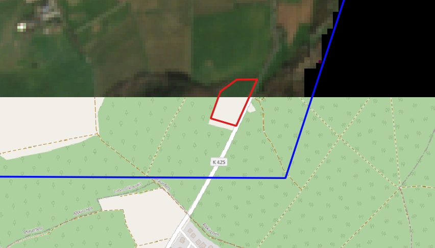
What I actually want to achieve: I want to check whether a given area of interest (AOI) is completely covered by a product. As indicated here, I have to do this programmatically.
So I thought the footprint of a product (“manifest.safe” under “metadataSection/metadataObject/metadataWrap/xmlData/safe:frameSet/safe:footPrint/gml:coordinates”) could be used for this. Unfortunately, I do not understand how to interpret it correctly.
As the attribute “srsName” indicates, these are WGS84 coordinates. Since the polygon only describes the corner points of the image, the coordinates must be transformed from EPSG:4326 to EPSG:32632 (“MTD_TL.xml” under “n1:Level-2A_Tile_ID/n1:Geometric_Info/Tile_Geocoding/HORIZONTAL_CS_CODE”) in order to obtain the actual footprint (i.e. the edges of the footprint match the edges of the image). This works perfectly for products that cover a complete tile (e.g.: S2B_MSIL2A_20240309T102749_N0510_R108_T32UMB_20240309T131347.SAFE)
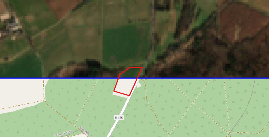
However, products that only cover a fraction of a tile (at the edge of a scan, i.e.: S2A_MSIL2A_20240406T103621_N0510_R008_T32UMB_20240406T164651.SAFE) seem to cause problems. After transforming them, I see an misalignment between the footprint and the image data. Furthermore, this leads to the incorrect classification that this product completely covers the AOI.
Am I getting something wrong?
AOI as WKT:
POLYGON ((8.405738070800652 50.46136832675154, 8.40675979328995 50.46284617225021, 8.405744537399414 50.462829706259356, 8.40494267924393 50.46245510342209, 8.404470617586924 50.461598857222896, 8.405738070800652 50.46136832675154))