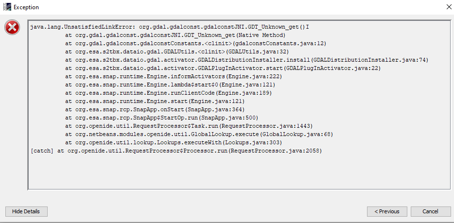
I cant use snap because of this error. can you help me?
Please describe what data you are using, where you downloaded it and which processing you already applied.
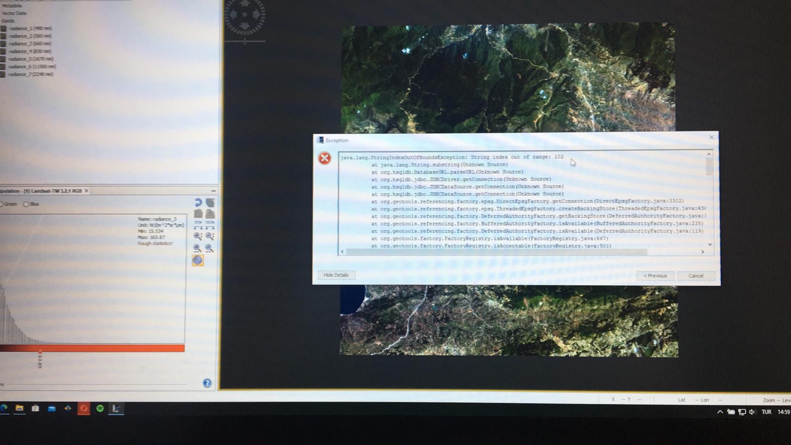
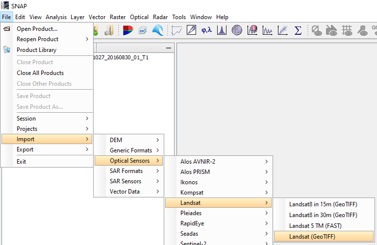
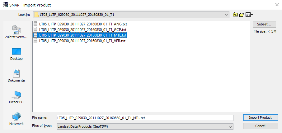
Landsat 5 image. Download from Usgs explorer. I downloaded and opened, thats all.
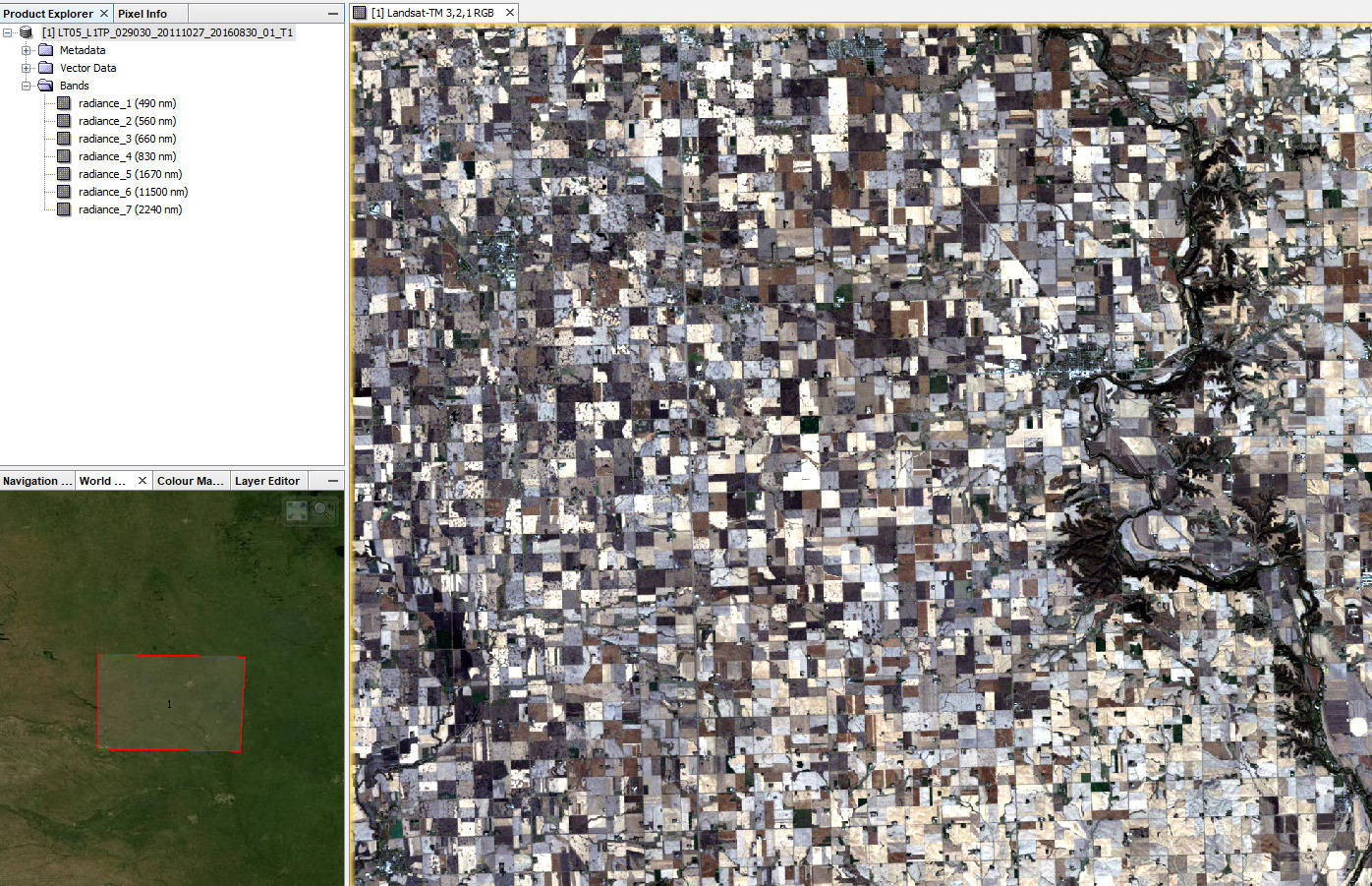
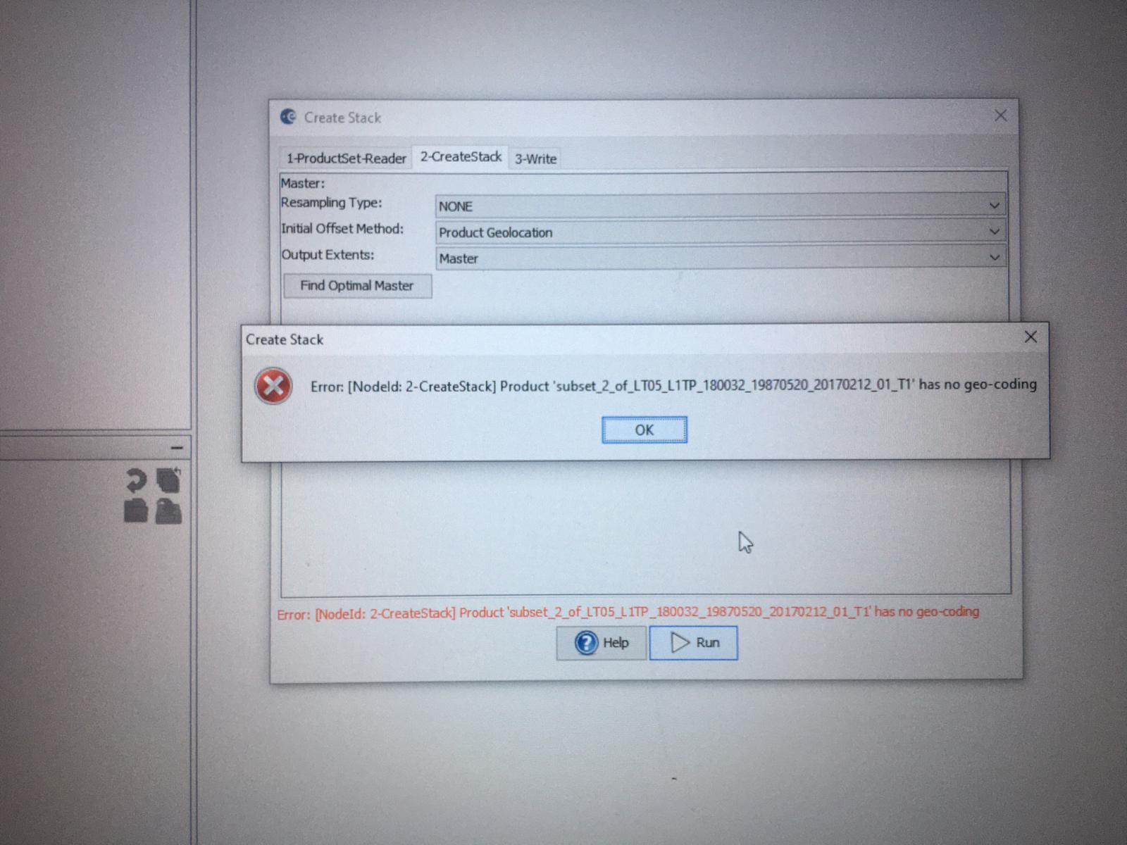
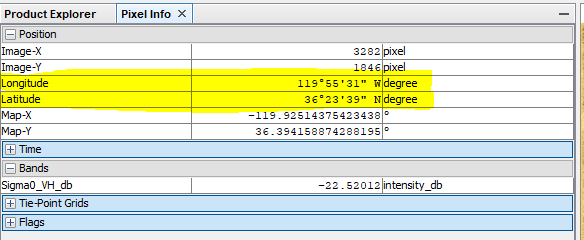
I opened like that but i get this error. Also i can not see geographic coordinates. Only pixel coordinates.
Can you help me? I opened product but i can not see geo coordinates. I can not do reprojection.
you can switch to the Pixel Info tab to check if your data has geo coordinates
Have you tried Tools > Attach pixel geocoding ?
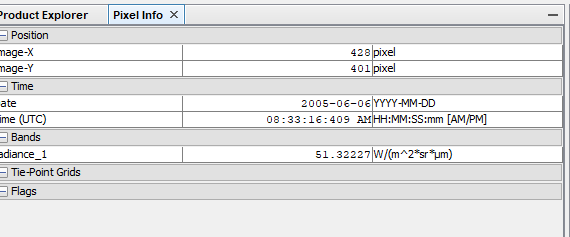 There is only pixel coordinates. I checked with another Landsat 5 image and Sentinel-1 image but still not working.
I have no idea where the geocoding has gone. Have you tried @Monica_EC’s suggestion?
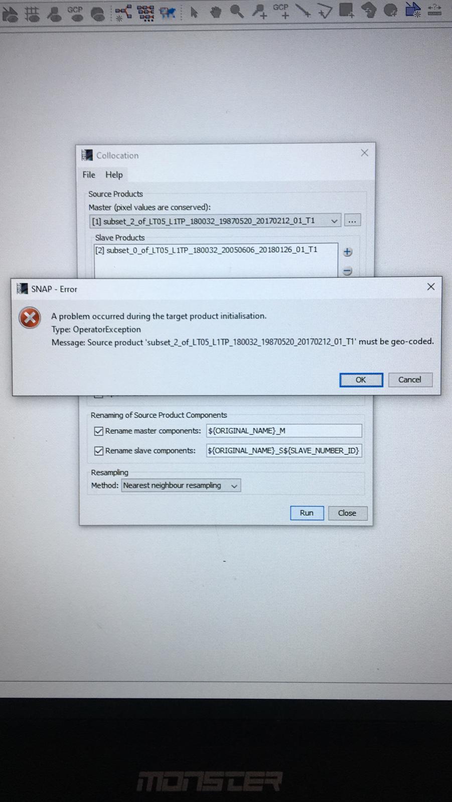
My file also not have geolocation, I tried to attach geo-coding on that box I have 19 band , now which band i need to choose? There is no lat, long band in that box
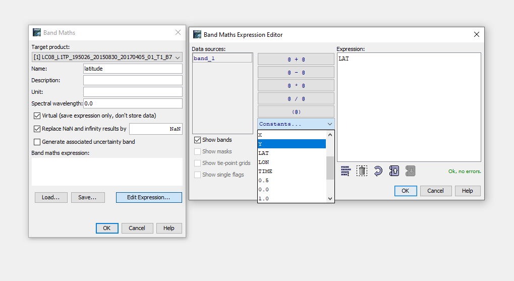
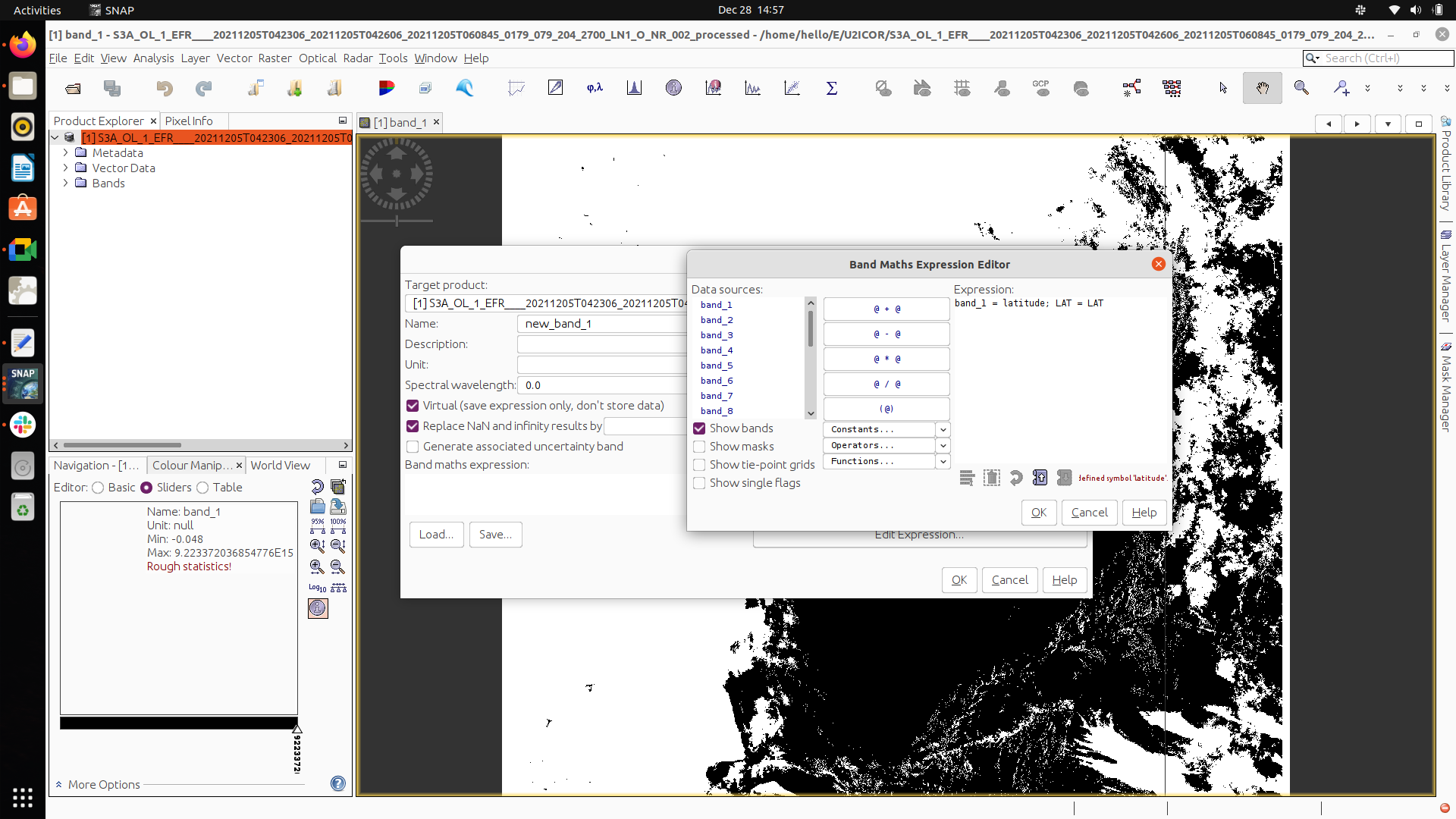
Can you create one with the Band Maths by inserting the x and y bands as constants?
sorry Still confusing , may I know how to enter band math farmula …
Please have a look at this post: RGB pixel info and positioning - #2 by marpet
Especially “more steps 1 and 2”
Thanks ,
band name = latitude; expression = LAT
band name = longitude; expression = LON
band name = pixelX; expression = X
band name = pixelY; expression = Y
here band name - I have 19 band what should I select
latitude; expression = LAT This line same for me or need replace anything
Band name is the one you give in the Band Maths for the new raster, you can call it whatever you like as long as you remember which one is latitude and longitude.
You don’t need X and Y.
I tried this Expression it say undefined latitude
band 1 = latitude; expression = LAT
Not sure if this is a misunderstanding - only put “LAT” in the expression.
“latitude” is just the name of the band.
band_1 = latitude; LAT = LAT
still error
thanks fo your respond - I am stucked with this step (missing lat long since last 4 days)
 It’s much simpler.