Hello,
I hope that everyone is doing Will?
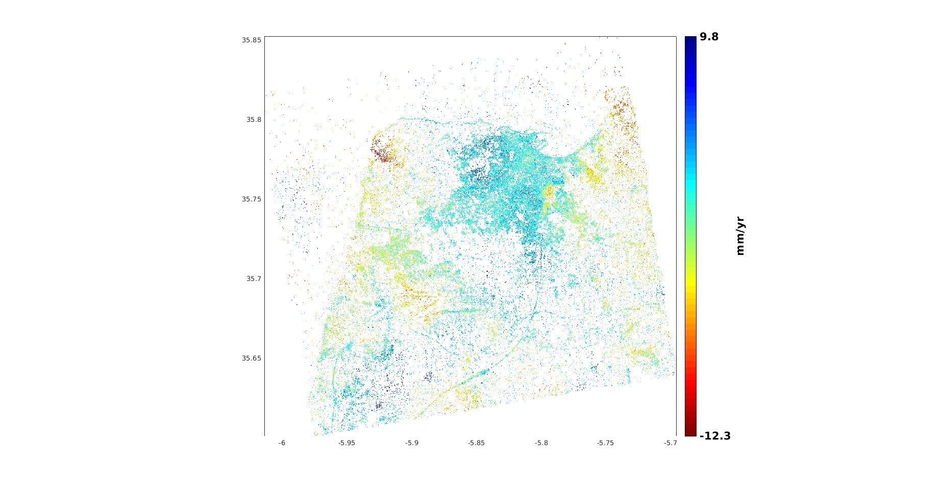
I generate a displacement map (mm/year) using PSINSAR, and know I would like to export the results in KMZ or KML format for GoogleEarth visualisation, and i dont know how?
Can anynone here tell me how can i export it?
thank you
Is it possible to use DEM generated by InSAR in a certain area to apply STAMPS to calculate subsidence in this area?
how can i generate Single TS selection using StaMPS visualiser like you do? thanks so much