Radar Vegetation Index

Ok. I am trying to do that. In SNAP how to calculate RVI?

you can access the raster values with the Band Maths: https://www.youtube.com/watch?v=D4lSjLfPVwY

I am calculate the RVI in SNAP but how to check RVI range in SNAP?

After calculating RVI with above described formula, I am exporting the RVI with Two Sigma0_db band and DOP. When image was open in arcgis then value range is showing 1.5 to -3651.56.

with the histogram or statistics tool

Don’t export to GeoTiff, simply open the img files inside the .data folder of the BEAM DIMAP product in ArcMap. Conversion of formats potentially rescales the data.

1 Like

As your consulting, I am calculated the RVI without linear to db conversion. But RVI value range is come between 0 to 4 where its suppose to be 0 to 1.

So my consulting is why RVI value range is exceeds 1.

is your data calibrated to Sigma0?

Please have a look at the histogram of the RVI to see the range of the data.

Yes my data is calibrated to Sigma0. I checked the histogram, max value showing 4

I understand that, but maybe these are outliers caused by double bounce or volume scattering while the majority of the data lies between 0 and 1.

Please show the histograms of both input products (VV and VH) as well as of the RVI.

I tested with my data and also get some values above 1. The linear scaled RVI looks better than the dB scaled one.

this is how I calculated it

DOP = Sigma0_VV / (Sigma0_VV + Sigma0_VH)
RVI  = sqrt(DOP) *((4*(Sigma0_VH))/(Sigma0_VV + Sigma0_VH))

This is the value range
grafik

The thing is, the link you provided does not allow to check if this index really ranges between 0 and 1.
I would just see it as a relative measure, regardless of the scaling.

Maybe you can get in touch with the author.

Can you tell me what are the pre-processing steps you followed before calculating RVI? Because this time I am calculating RVI in linear scale but this time I am getting Lowest value in minus and when I am open RVI.img file in arcgis its completely white like this

Radiometric calibration to Sigma0 and Terrain Correction.

You have to apply a correct color stretch in ArcGIS, the nodata value outside is not set correctly. Go to the symbology and stretch the colors between 0 and 2 to have better visual contrasts.

Now its work correctly. Thank you for your guidance.

Hi! Do you know how to calculate the RVI using SEntinel 1 in GEE? The values are in db and I have to convert it to linear because the formula is RVI = 4VH / VH + VV

Thanks

Hi,

I was trying to convert my sigma values into the power unit (dB to linear), but having a problem with the expression I write (as in the image below). does the formula is wrong? I am using the formula referring to Tomcater’s post: Creating Radar Vegetation Index

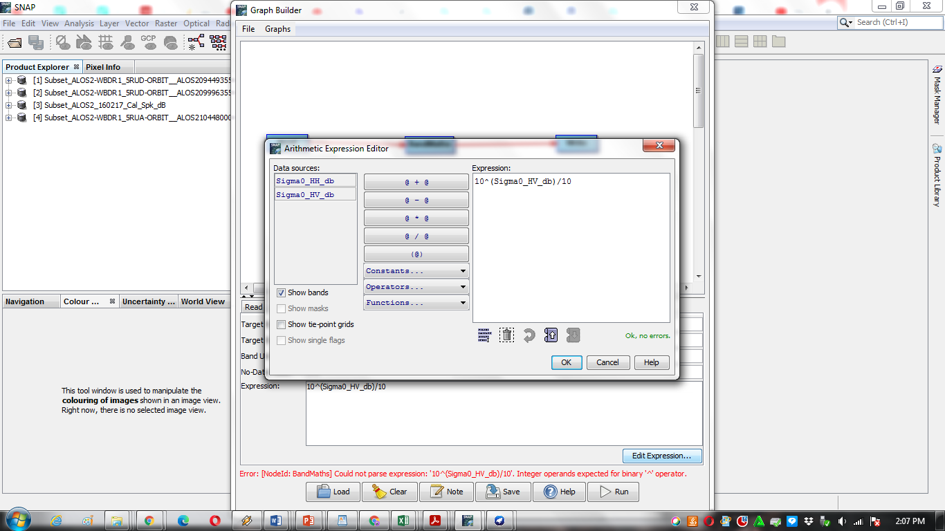
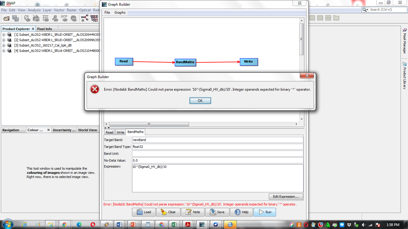
could you advise me? thanks.

please try

10^(ABS(Sigma0_HV_db)/10)

Can we use gamma0 instead of sigma0 to calculate RVI?

Sorry, I did not get it. Why this multiplication?
RVI = (4*(Sigma0_VH))/(Sigma0_VV + Sigma0_VH). Right?

The calculation refers to the custom script mentioned in the first post. Different papers might use other formulas.

1 Like