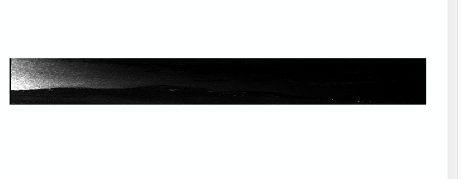
I’m trying to bring some radarsat 2 data into arcgis. I’ve callibrated it, used a speckle filter, multilook (4x4) and am getting a strange projection. Please see incorrect display below. it should be more square represented on a black background.
Any ideas? Is this an issue with my geometric correction?
What type of product is it? If it is a SLC then it is longer in azimuth then it is in range so to get square pixels you will need to multilook 4x7 or something depending on its pixel spacing.
Also, you will want to terrain correct the product first before exporting it to ArcGIS so that each pixel is properly geocoded and projected.
Im trying to do this with a variety of products namely:
Radarsat 2
Sentinel 1
Alos 2
Good point on the azimuth though I think really this must be a terrain correction issue.
I appreciate the help Iveci.
This communication may contain confidential information which also may be legally privileged and is intended only for the use of the intended recipients identified above. If you are not the intended recipient of this communication, you are hereby notified that any unauthorized review, use, dissemination, distribution, downloading, or copying of this communication is strictly prohibited. If you are not the intended recipient and have received this communication in error, please immediately notify my by reply email, delete the communication and destroy all copies.