actually, there is no need for reprojection after the Terrain Correction step as you already define a target coordinate reference system. Also Converting to GeoTiff is not necessary, you can directly open the img files in the data folder in almost any GIS (QGIS, ArcMap…)
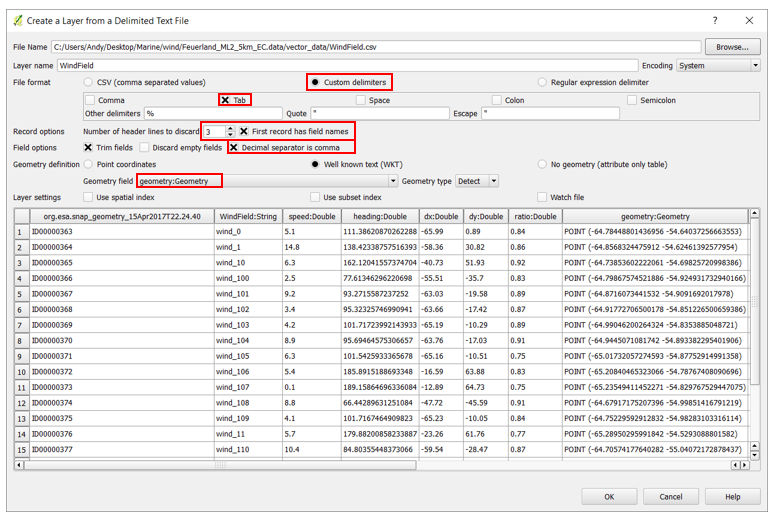
If it is the same as in wind field module, the movement vectors can be found as a XML or CSV file
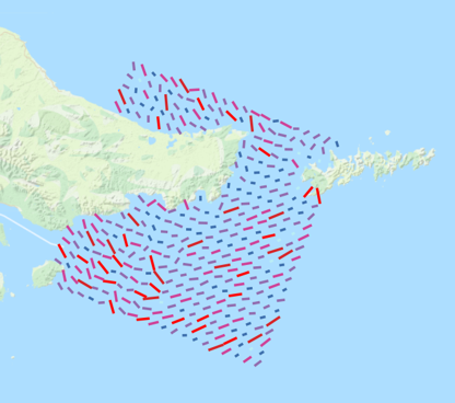
The XML can be opened in Excel and stored as a table with coordinates which then can be opened in any GIS . Here, I imported the CSV data of wind field estimation directly from the data folder in QGIS: