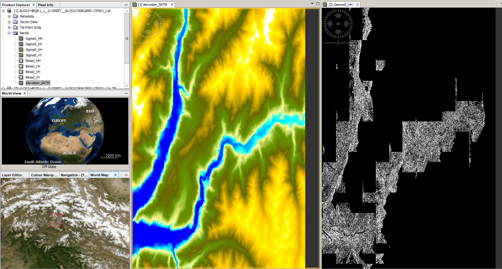
I couldn’t understand where is the problem. I performed Terrain Flattening with SRTM 1sec, SRTM 3 sec and external TanDEM-X 12m DEM (in WGS84) but getting same outcome. Kindly guide me where is the problem.
I have received the data and can confirm the errors. I first thought the SRTM would have errors in this region but it looks totally fine. Sigma0 and Beta0 also have reasonable values. Can’t think of a reason why this happens, sorry!