Hello,
with help of step team I successfully apply the following step to 4 IW data (GRD) in Amapa in Brazil.
I apply the following step:
Calibration -> Multillooking 2x2 to reduce image size and reduce ram use -> Terrain Flattening (default value) -> Terrain Correction.
At last I convert the 2 polarisation in dB and I build a new channel equal the vhdB-vvdB in order to to the folowwing color composition: R vvdB, G vhdB, B vhdB - vvdB
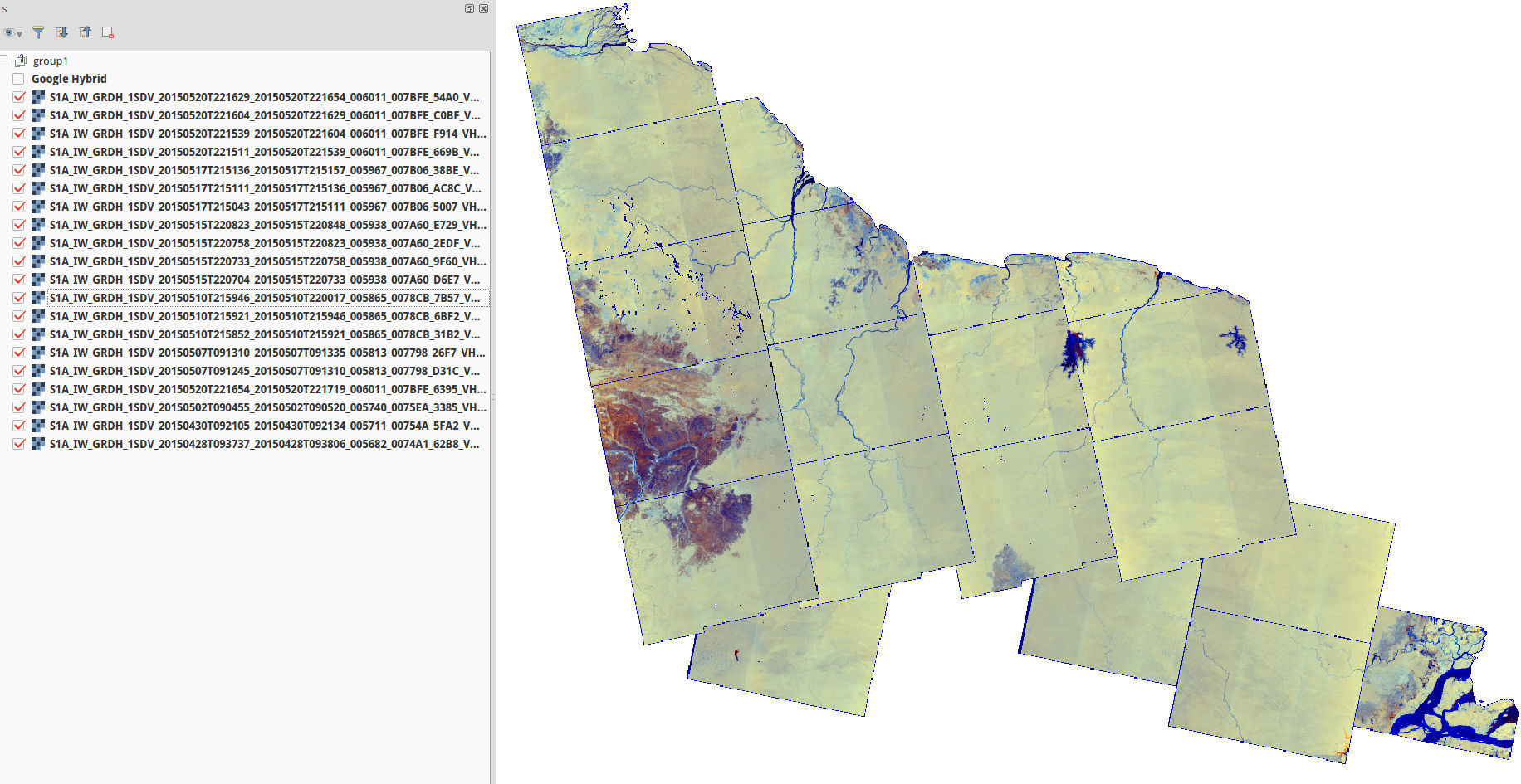
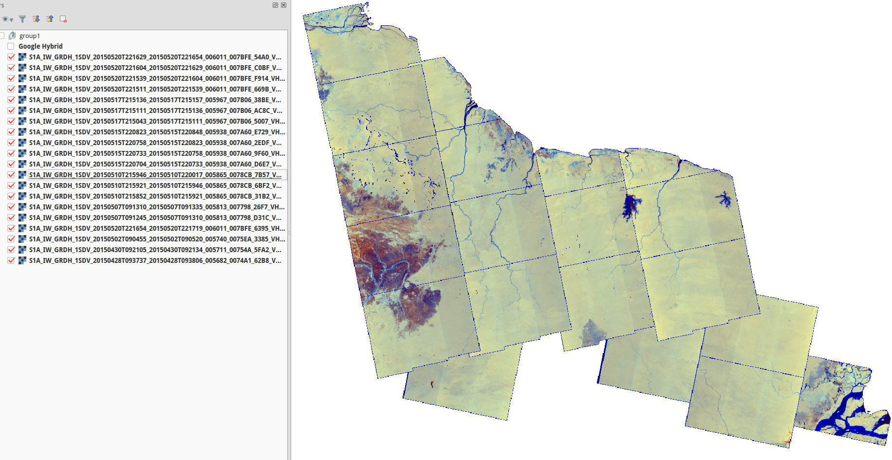
So, when I put this 4 data in Qgis and when I adjust the display stretch in order to have exactly the same min and max I obtain results shown in screenshot.
As you can see in the left part (data are underline in layer area in the screenshot) we can see, I think, radiometric effect between the different sub swath in the data.
Thus my first question is how to remove this effect if possible ? Use SLC may be and apply specific processing ?
My second question is due to the ligth radiometric variation between the near and far range. I know that in practice, depending on land cover it could be difficult to remove this effect but I believed that on forested area with radiometric correction (here terrain flattening) we could reduce this effect in order to have more homogeneous mosaic. I agree that the acquisition are not in the same time for the two pass but wathever the data we see this effect.
In addition, when I see Romania mosaic os Sentinel-1 build by esa I don’t see this kind of effetct this is why I would like to be able to have similar resuslt as Romanian mosaic.
Thanks in advance
Edit: I update the screenshot with last results on all the Guiana Shield
3 Likes
Somebody from Researchgate give me the reason:
As written in this reports it’s seems due to range effect between subswath.
And to remove it, it’s possible to remove the mean background range profile (see p11-12)
http://publications.jrc.ec.europa.eu/repository/bitstream/JRC92666/lbna27031enn.pdf
Now I will investigate how to do it… finding the way to average all row using mask to remove extrema…maybe somebody know how to do it in SNAP/S1TBX ?
Best
Clardeux,
Did you use the SAR mosaic options as well? It may do some further smoothing (i.e. feathering and normalisation).
The subswath effect is most evident over relative homogeneous areas, like the sea surface in your reference and your tropical forest case. It shows up less strongly over land areas that have more variation in land cover types like the Romania mosaic and if you average more over time and or asc/desc combinations. Subswath trend removal would indeed be a useful function.
Guido
Hello glemoine,
thanks for information.
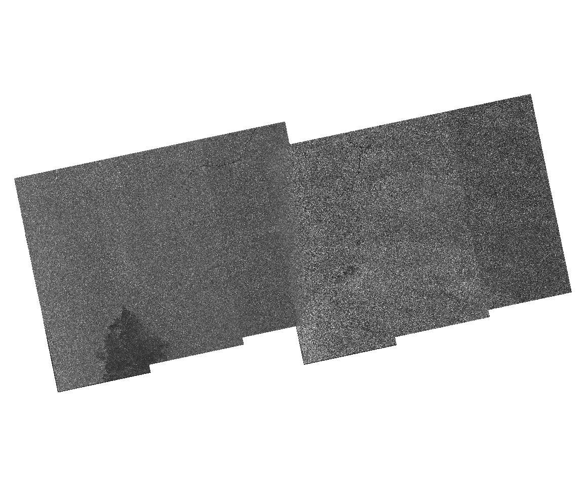
I have just now try using sar mosaic and result is not enough satisfactory as shown in the screenshot (only VH polarization). Indeed, yes we see smoothing of the overlay but the main radiometric effect is still here.
I will investigate, as shown in the previous report, to estimate on guiana shield data the average radiometric change depending on incidence angle in order to remove it from the dataset.
About that I think that this effect is probably the same whatever the IW data and consequently I would apply it to every data… did you think that this assumption is valid ?
Best
Hi,
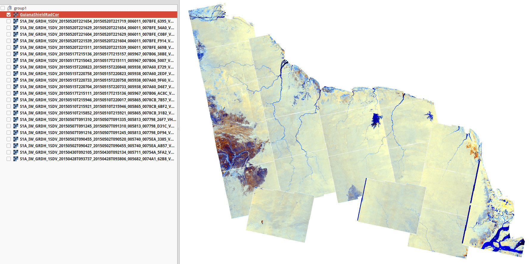
In order to try to remove radiometric variation due to strip and to incidence angle In addition to the following process: RemoverBorderNois - Calibration - ML - Terrain Flattening - Terrain correction, just after ML I have divided every line by the average line of one data (data with most homogeneous forested area) and multiply by its mean in order to have same average absolute calibration.
As shown in this two screenshot (before/after), results are really improve but not perfect.
Indeed, the radiometric variation seems to be not exactly the same in the different pass even is I think that some differences could be due to moisture change.
Some small problem are probably due to border removal process which does not work well at right part for 3 data (I have to see why) and between the same pass I have a gap of 2 pixels (may be better to slice data before).
In summary, results are not bad but I thinks it’s possible to obtain better results.
So, if you have any suggestion to improve it I will try it 
However, did you think that it could be possible that ESA correct strip effect or that Snap would do the work ?
Thanks for this nice software !
Since the launch S-1 product radiometry is still not what we would have it hoped to be.
The jumps between sub-swath is the result of that.
We have been working along this year to understand what is the issue behind it. This have required to keep the processing baseline stable (from the radiometric point of view) and to perform a dedicated calibration campaign.
This helped to understand where is the issue is (althought we still not found the root cause of it) and to put in place a corrective measures.
Please see the following threads:
https://twitter.com/search?f=tweets&q=%23sentinel-1%20calibration&src=typd
or directly
http://bit.ly/1ThCjNm
Again, thanks a lot for your documentation.
I am happy that this issue is solved and as I said in other post last data looks really better !
Best