Hi, all!
Want to get the normal map of the vertical displacements. Issues, including all recommendations, read books and articles, a lot. The essence of the process is clear. However, the final implementation raises some questions. Namely:
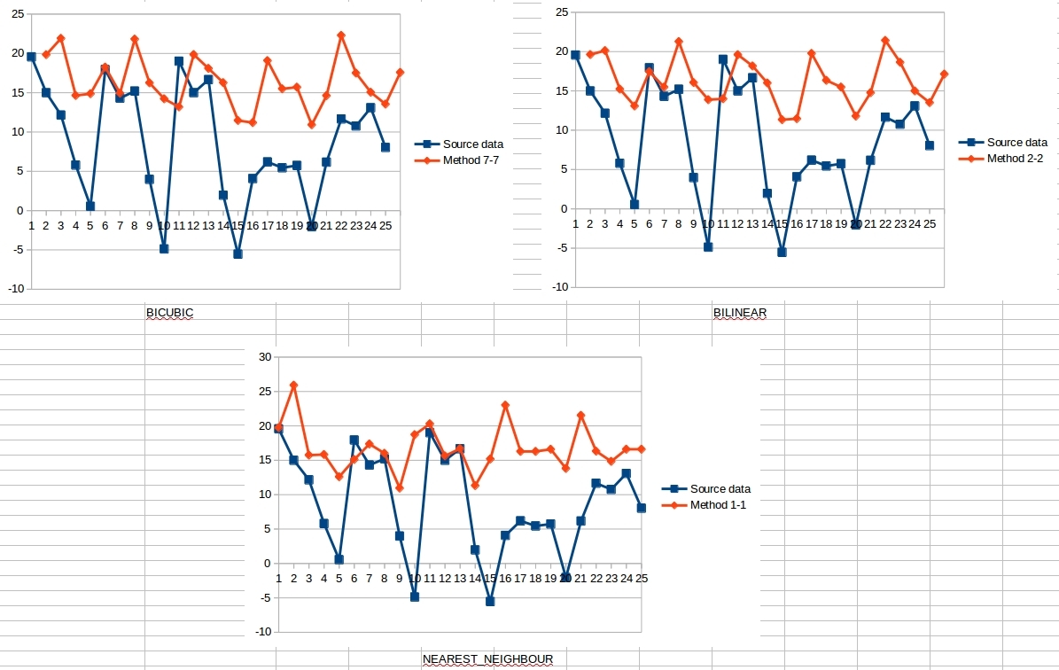
This figure shows a small fragment of the dataset from the displacement map. During the procedure Range-Doppler Terrain Correction, I went through almost all of the recommended interpolation methods. This figure shows only three of them. Why the calculated data is so badly distorted? All the accuracy practically reduced to zero… Software: ESA SNAP 4.0. How to overcome?