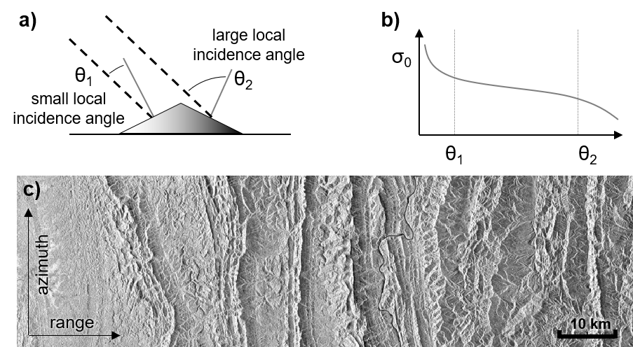
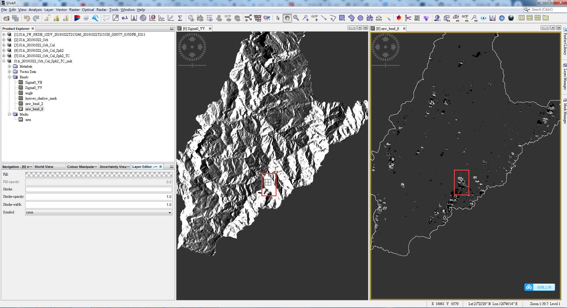
your study area is strongly affected by topography. But not all of this is real “radar shadow”, which is by definition the are which cannot be reached by the microwaves due to the incidence angle of the system and the steepness and orientation of slopes.
The variations in radar backscatter which we can see in the first screenshot are radiometric distortiongs resulting from different angles of the signal reaching the surfaces. Areas which face towards the sensor are displayed brighter than areas facing away from it. This can be corrected by the Terrain Flattening operator I mentioned in the second post.
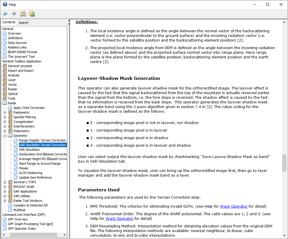
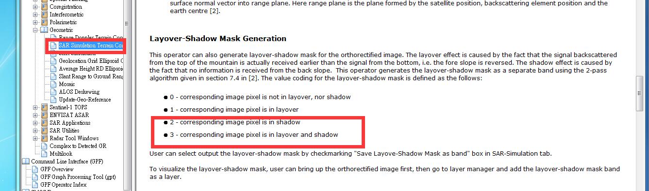
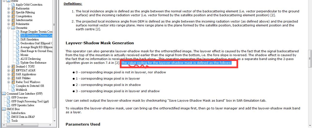
Referring to your second screenshot - the coding of the pixels is explained in the Help. Use the tabular color assignment (Color Manipulation tab) to get a more suitable coloring of the shadow/layover mask.
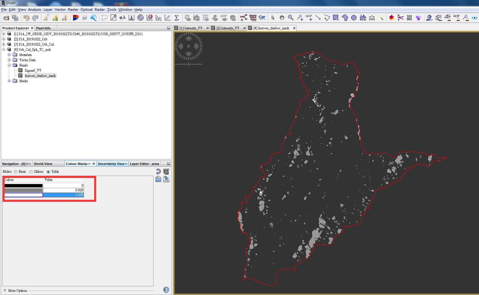
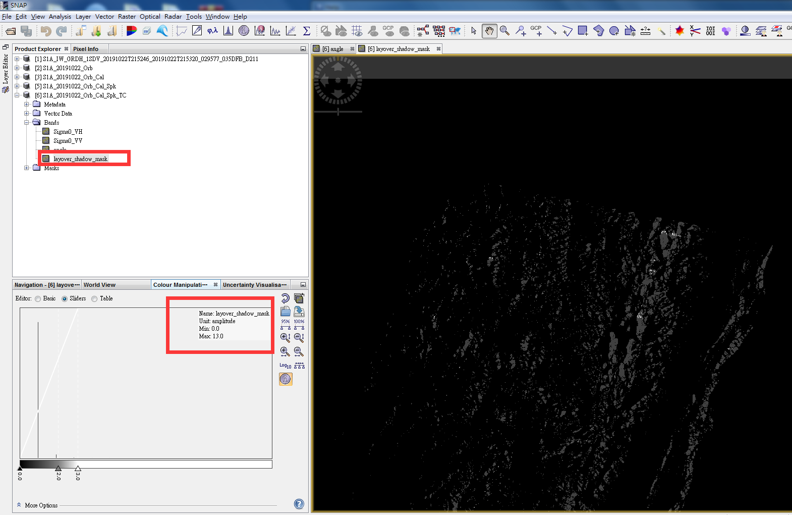
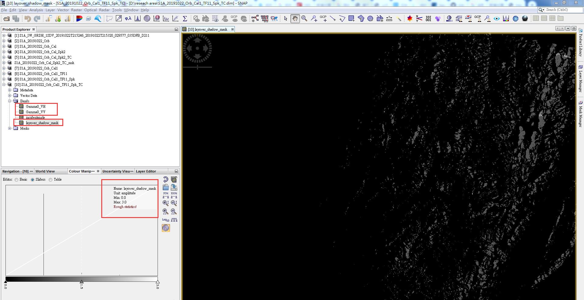
thank you very much.you help me a lot.I have seen the shadow’s value of my reseach area,is 0-1.658,and in help I see * 2 - corresponding image pixel is in shadow
3 - corresponding image pixel is in layover and shadow ,there is no 2 and 3 value in my result,so is it means that the influences of shadow of mountain and terrain in my reseach is Acceptable? can I start my reseach about soil water directly?
hello ABraun,I have found that the value if not been rough statistics is 0-3,but if I
Click the rough statistics the data is 0-13,so how can i get the value 0-3 again ,and remove the value of 2 and 3 from my reseach area?
simply enter the values in the data manipulation table as you need them. SNAP (sometimes neglects outliers)
Shadows and layover areas cannot be removed, I’m afraid. You can simply turn them to “NoData”, for example using the mask manager.
thank you for your reply.May I ask what the value of shadow zero to thirteen been rough statistics means?why not the value is not zero to three?if the data is 0-3 ,can I export the shadow data to tiff. and transform tiff. to shapefile by the value of 0-3,and extract the value 0-1 where is no shadow.
in case you converted your data to GeoTiff, the range of the raster values might have changed. I recommend sticking to BEAM DIMAP for all calculations so the initial values are preserved.
What did you enter in the band math?
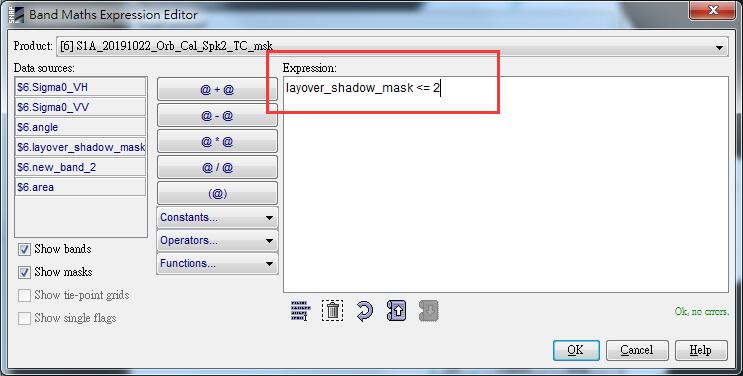
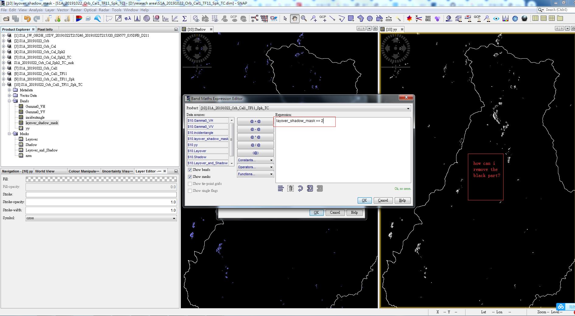
Let’s say 2 indicates shadow in your mask, you create a new band with
IF layover_shadow_mask == 2 THEN NaN ELSE Sigma0_VV
this copies your Backscatter to a new product but assigning nodata to all shadow pixels.
Solution 2: You can even use this in the properties of your Sigma0_VV raster (properties), by adding this phrase in the valid pixel expression: layover_shadow_mask == 0
my teacher says my reseach area have many mountains ,and the altitude is about 2000-3000meters,so my reseach area will be affect deeply by shadow and terrain.so these days I just want to find a way to solve the problem
you means use Gamma0? I always use sigma0,so i will change right now.and i try
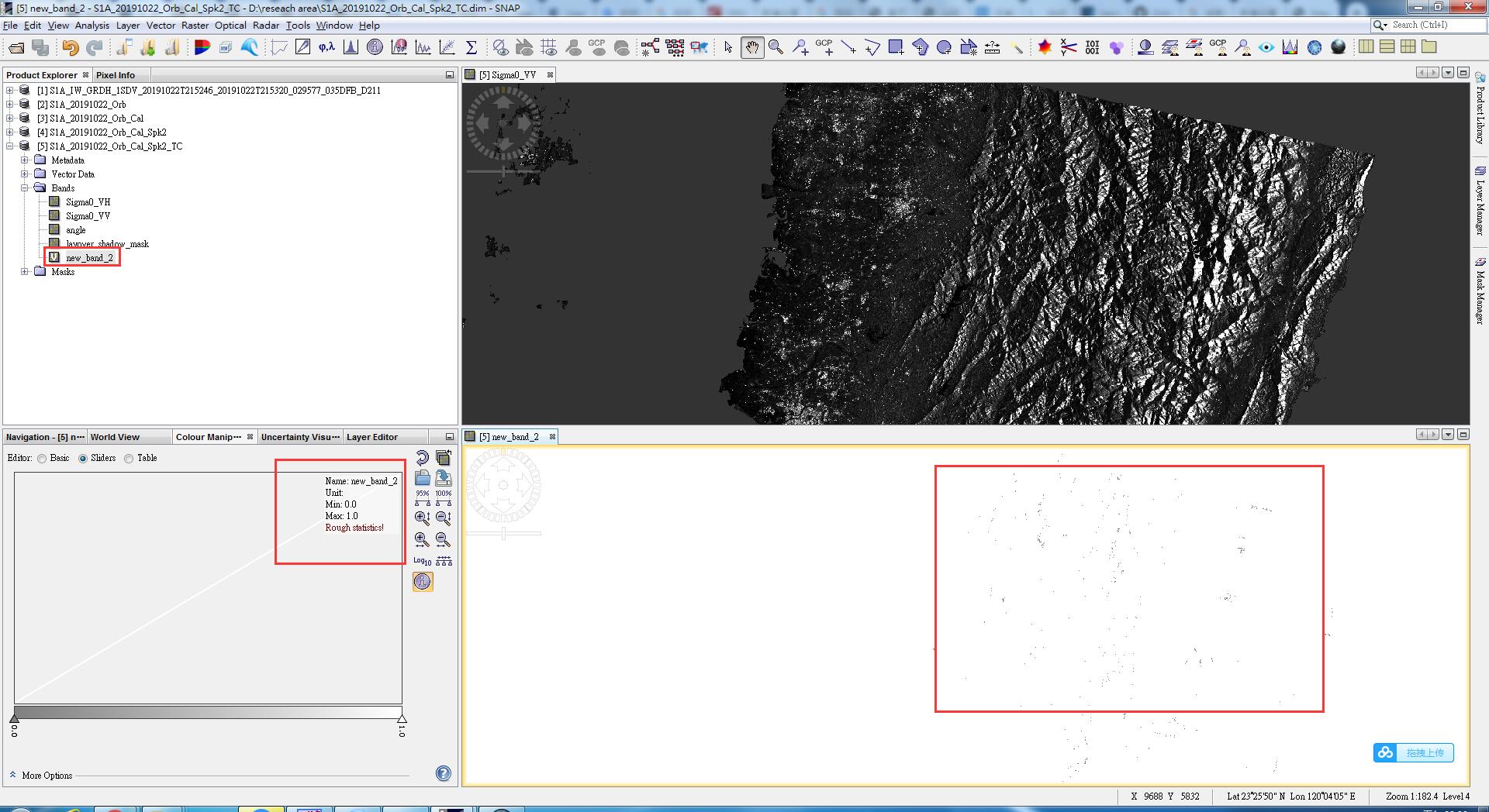
IF layover_shadow_mask >= 2 THEN NaN ELSE Sigma0_VV in the band maths,the result is like this
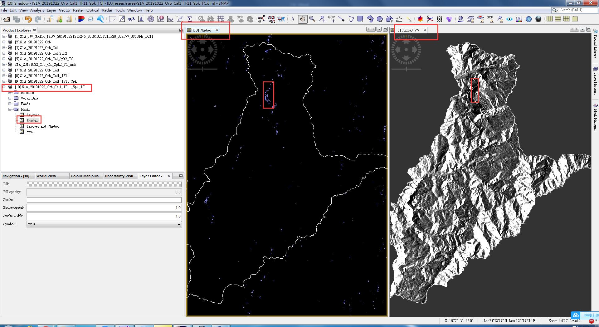
based on your screenshots above, only few pixels are 2 and above. If you use another shadow mask, please adjust it to the value which indicates faulty data.
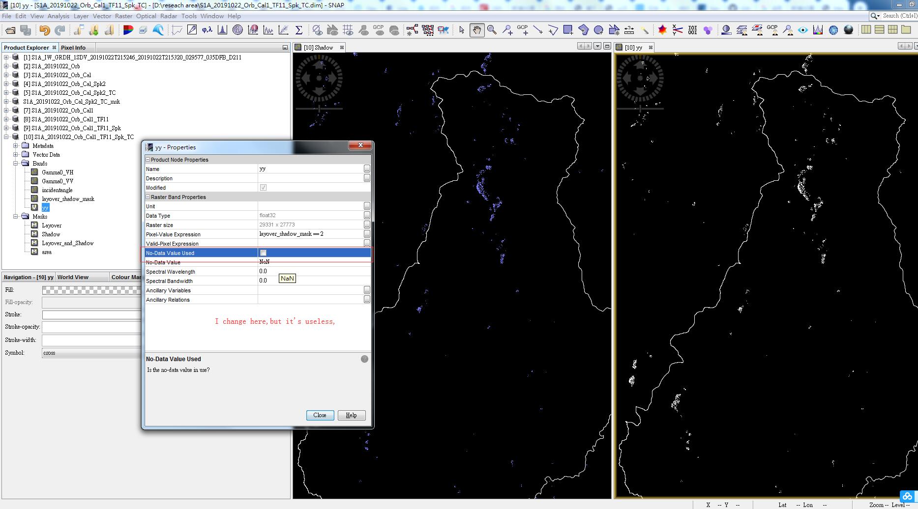
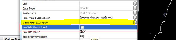
The example I showed above only works if the correct pixels are 0 in the mask
as you say,I do the calibrate with Gamma0 ,then the terrain flattening,after this i do the SAR Simulation Terrain Correction which has an extra option ro output shadow and overlay areas. the result is like this,so how can i exrtact the shadow which value coding is 2 and 3?do use band maths and import:layover_shadow_mask>=2? and my reseach is about soil moisture,so i need use sigma0,but here i use gamma0,how can i do with this?
you inserted it in the wrong line, you need to define which pixels you want to use (all which are 0 in the mask) in the valid pixel expression layover_shadow_mask == 0