Hi,
I’m trying to reproject S3 - OLCI so it would fit into the grid of S2 (e.g. one S3 pixel would contain 30x30 S2 pixels). (The result does not have to cover exactly the same area as S2)
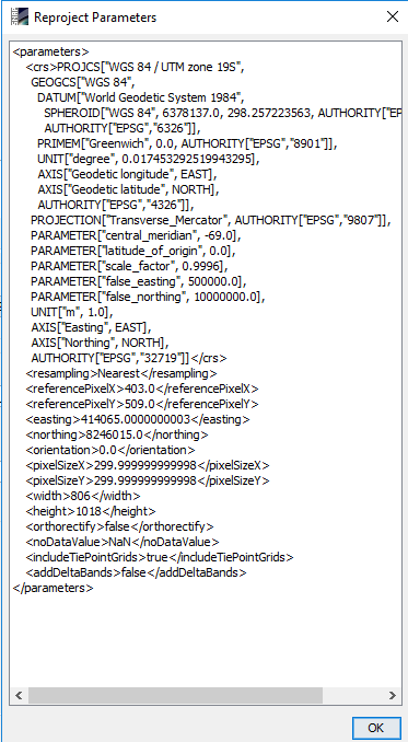
Workflow
Subset the S3 data
I chose same projection as my S2 data (epsg:32719)
Uncheck ‘preserve’ resolution and choose
o ‘easting’ / ‘northing’ so it would fit into S2 grid
o ‘pixelSize’ to a 30 x S2 pixel size
The result fits into the S2 grid as expected and sometimes the pixels cover the right area but often is shifted towards X/ Y over several 300m pixels.
Any ideas what I do wrong?
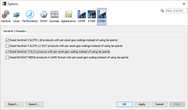
Maybe you are still using the tie-point based geo-coding. To get a more accurate geo-referencing you can switch to a pixel based geo-coding. But this will slow down the processing.
Thanks @marpet, I used the settings as you suggested. I made it work now anyway. I think the source of error was that I didn’t use the complete set (bands) of data when subsetting (geographicly) my data.
We had the same issue and turning on per-pixel geocoding did the trick. (Side note: When using GPT, make sure the setting is actually respected, which can be tricky because there are several places you can specify this.)