I have a question about the resolution of super-resolved Sentinel-2 images.
Although it is said that the resolution of all bands is resampled to 10m after super-resolving, as the previous post mentioned (Sentinel-2 Super-Resolution (all bands at 10m): Snap plugin now available! - #21 by Kat.Hurst), I do not think all the bands are resampled to 10m. When I visualize the bands whose native resolution is 60m, the resampled resolution looks like 20m.
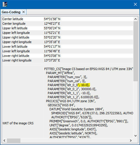
I assume that the pixel size is really 10m. You can use the range finder to measure the size of pixel. Or you can look into the Geo-Coding information panel (Menu: Analysis / Geo-Coding)
Probably the up-sampled images from 60m to 10m don’t look as sharp and crisp as the 10m images, but that due the the resampling. Even if they look like 20m, it is a nice result. @nicolas.brodu Maybe you add a few words?
Thank you for your replies.
I understand why not all the images are fine, but it is due to their original resolution.
Besides that, I did not know that I could check the size of pixels using the Geo-Coding. I am totally fine for the question.
I have another question about the super-resolved images.
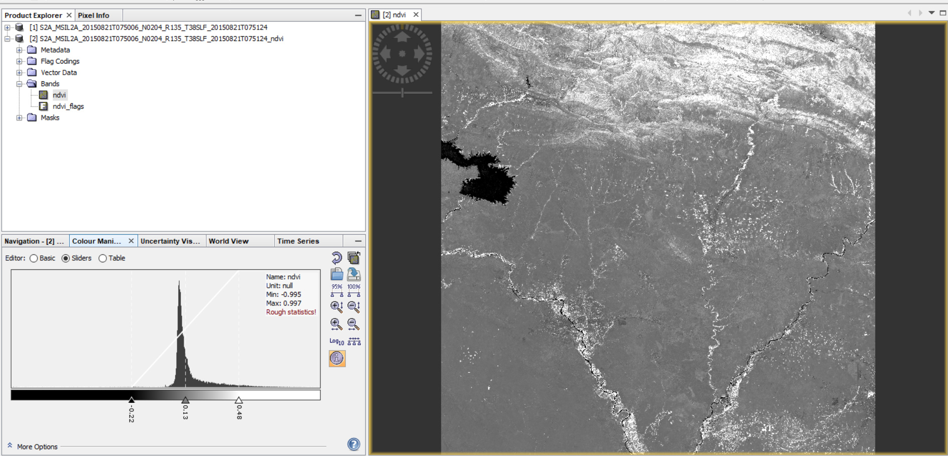
Can I calculate some index, e.g., NDVI, by using them?
I am not sure that I can use them for that purpose as this method is similar to pan sharpening. If the super-resolved images are considered as same as pan-sharpened images, I think I cannot use them to calculate the indexes.
The bands one usually uses for NDVI (B4 and B8) are originally in 10 meters, so you can use the L1C.
And I think the bands do not change when applying the super-resolution plugin. You can check the values to verify this.
For NDVI an L2A product might be better, but I don’t know if the plugin can use L2A data.
When you’re working with SuperRes or any resampling in SNAP, the metadata doesn’t always reflect the visual ‘crispness’ you’re seeing. To be sure about what the process actually spat out, I usually just double-check the pixel counts manually to see if they match the expected 10m or 20m grid.
I’ve been using this image dimensions finder lately just to quickly verify the height and width of the exported files without having to reopen them in a heavy GIS environment. It’s a lifesaver for a quick sanity check.