Hi,
I am trying to process S1 data using gpt. I used gpt for the read, apply orbit File, thermal noise removal, calibration. However when I use it for terrain correction I receive results with wrong projection. I define projection EPSG:32635, but Snap shows WGS84.
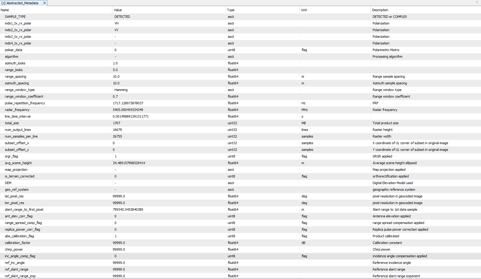
The MetaData looks
The used command are as follow:
gpt Terrain-Correction -Ssource=‘[D:/pysnap/04_calib/target.dim](file:///D:/pysnap/04_calib/target.dim)’ -PsourceBands=‘Sigma0_VV,Sigma0_VH’ -PpixelSpacingInMeter=10.0 -PmapProjection=‘GEOGCS[“WGS 84”,DATUM[“WGS_1984”,SPHEROID[“WGS 84”,6378137,298.257223563,AUTHORITY[“EPSG”,“7030”]],AUTHORITY[“EPSG”,“6326”]],PRIMEM[“Greenwich”,0,AUTHORITY[“EPSG”,“8901”]],UNIT[“degree”,0.0174532925199433,AUTHORITY[“EPSG”,“9122”]],AXIS[“Latitude”,NORTH],AXIS[“Longitude”,EAST],AUTHORITY[“EPSG”,“4326”]]’ -PalignToStandardGrid=false -PapplyRadiometricNormalization=false -PauxFile=‘Latest Auxiliary File’ -PdemName=‘SRTM 3Sec’ -PdemResamplingMethod=‘BILINEAR_INTERPOLATION’ -PexternalDEMApplyEGM=true -PexternalDEMNoDataValue=0 -PimgResamplingMethod=‘BILINEAR_INTERPOLATION’ -PincidenceAngleForSigma0=‘Use projected local incidence angle from DEM’ -PnodataValueAtSea=true -PoutputComplex=false -PsaveBetaNought=false -PsaveDEM=false -PsaveGammaNought=false -PsaveIncidenceAngleFromEllipsoid=false -PsaveLatLon=false -PsaveLocalIncidenceAngle=false -PsaveProjectedLocalIncidenceAngle=false -PsaveSelectedSourceBand=true -PsaveSigmaNought=false -PstandardGridOriginX=0 -PstandardGridOriginY=0
and the picture of results are as follow:
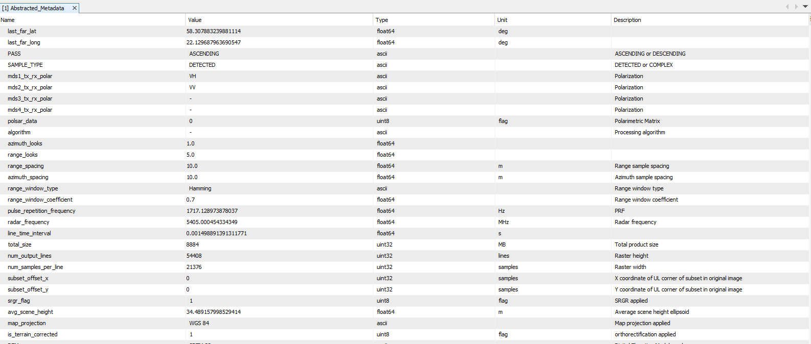
There are bug in map_projection, because it must be WGS 84 / UTM zone 34N.