Hi and good sunday to all!
I’m a new user of SNAP. I’m trying to do a coregistration between two Sentinel 1 SLC dataset but, as you can see on the screenshot, it’s shown me the error in object. My target is create a DEM from this two dataset.
How I can solve this problem? It’s possible to crop both datasets to obtain the same overlay?
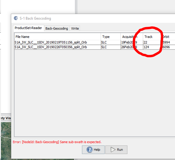
You cannot use the BackGeocoding to coregister S1 images of different tracks. Even if it would be technically possible to match both images, the resulting perpendicular baseline is too large for interferometry.
Have a look at the figure here: INSAR / DINSAR - Perpendicular baseline calculation
for searching the data, I recommend ASF vertex: https://vertex.daac.asf.alaska.edu/
It allows to specify numerous parameters and gives you more flexibility filtering your results
The track (here called Path) is directly shown in the results (a bit hidden in the official sentinel hub)