Good morning everyone!
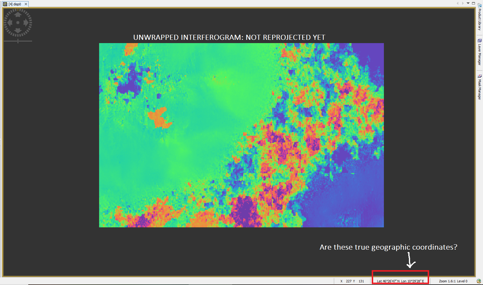
I’ve produced an interferogram using snap and unwrapped it with snaphu. After reprojection in geographic coordinates (Range doppler terrain correction) I’ve noticed some discrepancies with the coordinates values.!
My question is: when I open a SAR image some Lat Lon coordinates are visualized in the bottom bar. Are these the true geographic coordinates corresponding to the pixels?
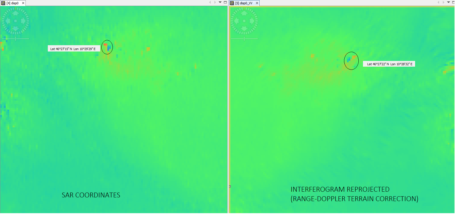
When I reproject the image and check it seems that the same point has different values in the reprojected map (they agree with google earth coordinates) and in the SAR one.
For example in the following image the same point (or cluster) has differet Lat value changing more than 1’.
Thank you for your help!
Cheers
