I can’t see any place indicating the scale of the displayed image in SNAP4’s main window. I see only a zoom factor, which is not the same thing.
If I didn’t overlook where’s the scale indicated, it would be great for SNAP’s users to be able to see/select the display scale as it is done in QGIS for example.
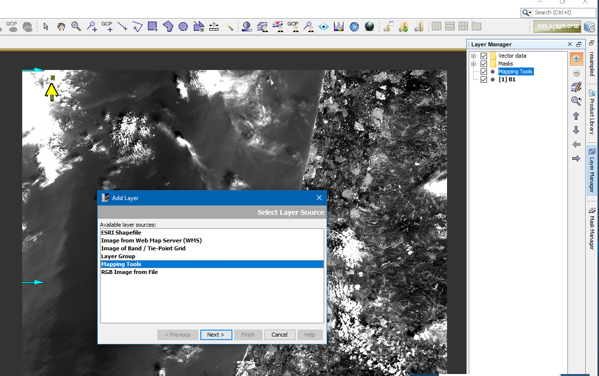
Open the Layer Manager and add the Mapping Tools layer. This gives you a scale and north arrow.
Currently, you have to do this for each product you open. We need to save your preference to always have them turned on by default.
Thanks for answering my question. I did add the layer with the scale and north arrow checked but how do I make the layer visible on top of the sentinel image?
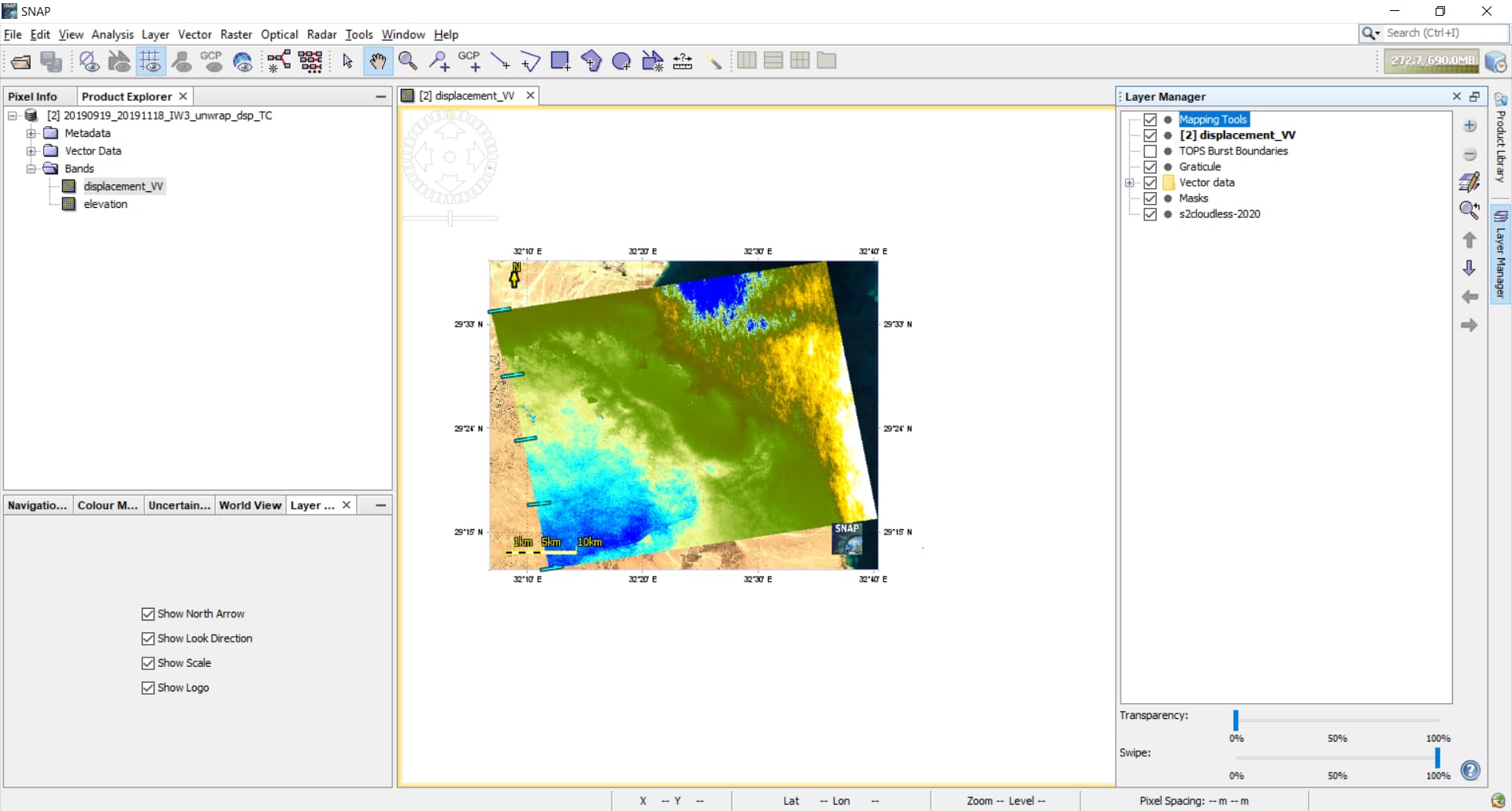
I can see both scale and north arrow without doing anything after adding the layer. The scale is located at the bottom of the image. Can’t you see it? If not, can you confirm that the entry “Mapping Tools” is present in the “Layer Manager” and that it is checked for display? Also, transparency should be at 0% and Swipe at 100%.
I can see the arrow and the scale but only if the whole image is shown on the screen.
If I zoom in, the scale and arrow don’t appear on the zoomed image, even if I uncheck then recheck the Mapping tools layer or remove it and dot it again.
This means that the scale is not linked to the display which makes it of no use. Indeed what we expect from a scale indicator is to indicate at what scale the displayed image is at the current zoom level.
More precisely, the scale does change with the zoom level but both the scale indicator and the north arrow are out of view because they remain at the same place.
What would be nice is to have a simple textbox at the bottom of the screen indicating the scale e.g. 1/50,000 as is the case with QGIS. It may even allow to select/type the desired display scale.
Maybe this is of use to some: if you do a spatial subset from view (possibly need to resample first), you can get a scale bar and north arrow on a zoomed in section. Not quite the same as seeing it change real-time with zooming like qgis (would be preferable), but at least it’s something…
You can use the layer manager to do this.
Then you can select the Mapping Tools. There 'Look Direction’ and ‘North Arrow’ are selectable.
But the ‘Satellite Flight Path’ can not be displayed.