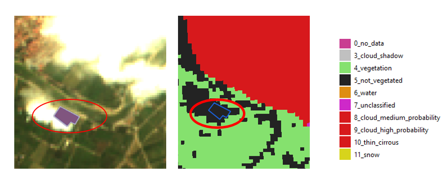
The RGB image is at the left and the clasification map from SCL file is at the right. According to the RGB image, the polygon is under a cloud. However, it belongs to not vegetated class according to the classification map. I have read about certain inaccuracies from classificaction file. In this example, I would like to understand if it is an error, or if it would be a correct classification in not vegetated class.
Hi @kraftek,
Yes, that is my doubt. I do not know if it is an especific mistake or if it would be a mistake between threshold class. Do you know if there is any updated documentation about SCL classification product? I would like to understand it.
Thanks