Hello everyone,
I am currently working on an algorithm that uses Sentinel-3 L1 RBT SLSTR imagery. Based on the cloud cover from scene classification maps, I check if a tile is usable or not. However, I’ve encountered recurring issues in certain regions where the classification algorithm seems to misclassify clouds and coastline areas:
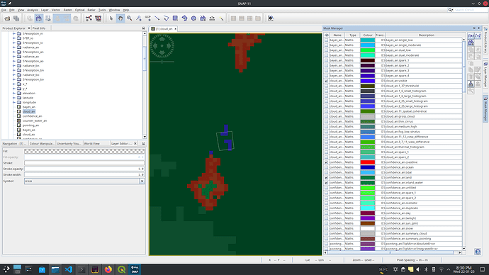
- Cloud Misclassification: Some regions incorrectly classify areas as clouds when they are clearly not.
- Coastline Misclassification: Certain areas lying entirely within the landmass are wrongly categorized as coastline.
These misclassifications significantly impact the scoring algorithm I am developing, as accurate scene classification is critical for my use case. The incorrect labeling of clouds and coastlines can lead to rejection of otherwise usable tiles, or flawed analysis results.
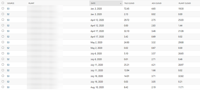
Notably, I have observed that Sentinel-2 imagery for the same dates does not show clouds in the regions where Sentinel-3 does. To showcase this behavior, I am attaching cloud information for some common dates.
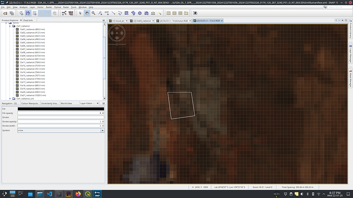
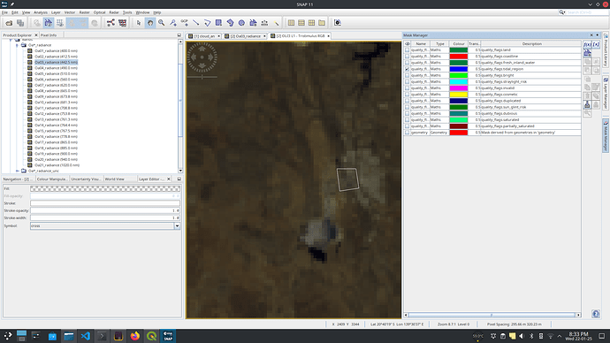
Additionally, I have included screenshots showing:
- A True Color Image (TCI) generated using OLCI.
- The corresponding cloud/land cover classification map from SLSTR.
AOI.kml (1.5 KB)
Tile Name: S3A_SL_1_RBT____20241222T001356_20241222T001656_20241223T093405_0179_120_287_3240_PS1_O_NT_004.SEN3
S3A_OL_1_EFR____20241222T001356_20241222T001656_20241223T002326_0179_120_287_3240_PS1_O_NT_004.SEN3
I am seeking advice or recommendations on how to mitigate these issues. Specifically:
- Are there post-processing techniques or additional data sources (e.g., DEMs or auxiliary datasets) that could help refine or correct these classifications?
- Has anyone faced similar issues with scene classification maps, and how did you resolve them?
- Would retraining the scene classification model with region-specific data help? If so, is there a feasible way to implement this with the tools available in SNAP or other ESA-supported platforms?
Any insights, suggestions, or pointers to relevant resources would be greatly appreciated.
Thank you in advance for your support!
Best regards,
Varisht G


