During usage of the “Range Doppler Terrain Correction Tool” I noticed strange behaviour. Regardless of the selected map projection, when I try to export parameters, created XML stores always “WGS84(DD)” as a selected projection.
Exactly the same projection I see when I select File --> Display Parameters.
Let me provide some screen:
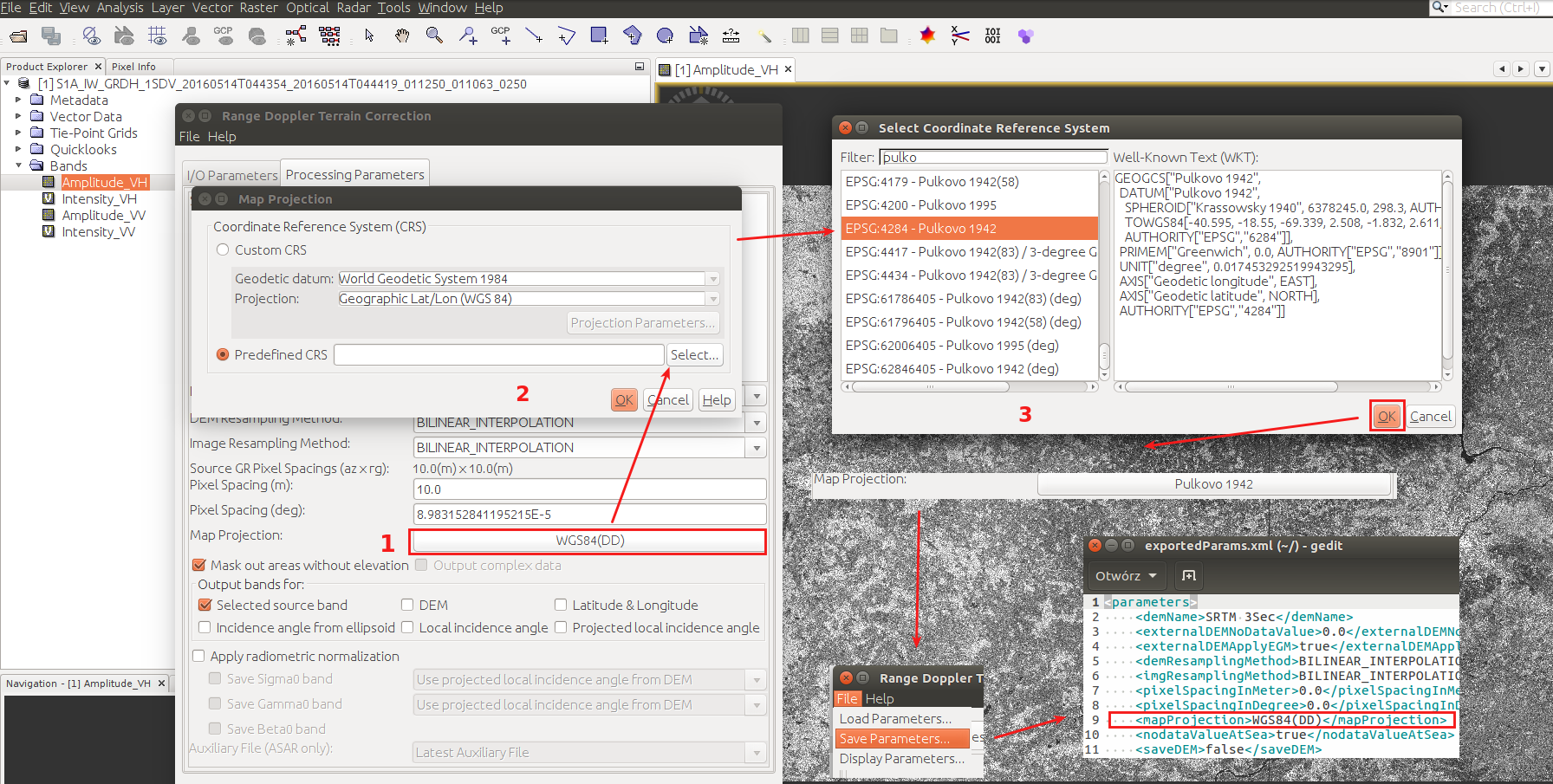
I was able to reproduce this behaviour for other parameters (such as Image Resampling Method).
I’m using SNAP 4.0, SNAP Engine 4.1.0, JRE: 1.8.0_60-b27