I am trying to perform atmospheric correction to S2A_MSIL1C_20230602T100601_N0509_R022_T32TQT_20230602T135148.SAFE with Sen2Cor v.2.11 (Sen2Cor-02.11.00-Linux64). The tile is from a mountainous region in Austria which is why I wanted to perform terrain corrections with Copernicus DEM (30 m resolution).
In L2A_GIPP.xml I made the following checks/changes:
And I am using ESA CCI auxiliarity data:
ESACCI-LC-L4-Snow-Cond-500m-MONTHLY-2000-2012-v2.4
ESACCI-LC-L4-LCCS-Map-300m-P1Y-2015-v2.0.7.tif
ESACCI-LC-L4-WB-Map-150m-P13Y-2000-v4.0.tif
I ran Sen2Cor with Ubuntu version 2204.2.33.0. The process was terminated successfully.
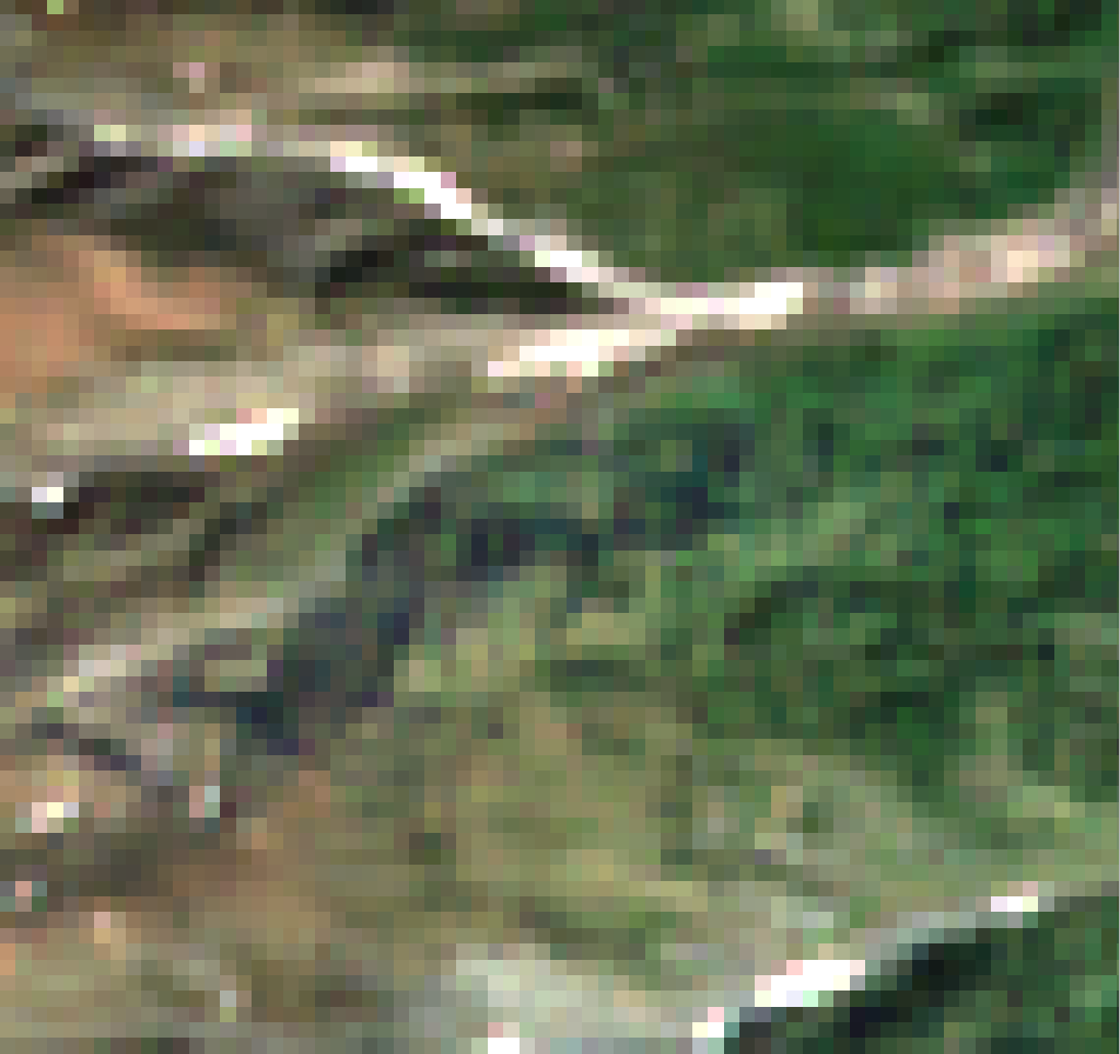
Next, I repeated the same process with the coarser Copernicus DEM, 90 m resolution.
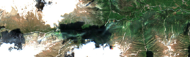
After my own processing, I also downloaded the official ESA L2A core product from Copernicus website, S2A_MSIL2A_20230602T100601_N0509_R022_T32TQT_20230602T162001.SAFE.
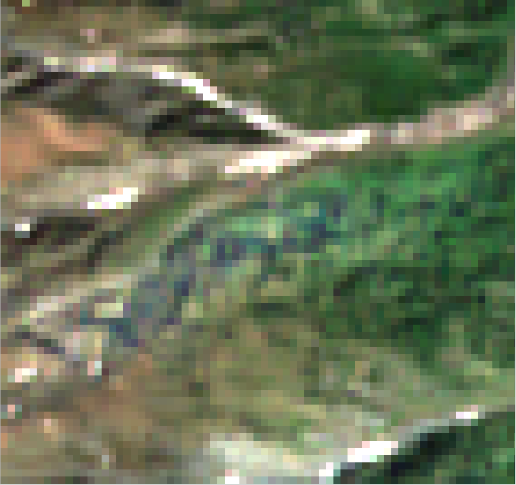
However, it seems like the Copernicus DEM with higher resolution created more visible shade and illumination patterns.
Result of Sen2Cor with Copernicus DEM 30m resolution:
As expected, the product created with 90 m resolution DEM matches the core product better because of the common resolution. But why does improved resolution (30 m resolution case) make the forest in the center look more pale? Is this an overcorrection issue? Shouldn’t higher resolution create better results? Is there a reason to use 90 m dem even when 30 m dem would be available?
Thank you for your detailed post with all the information required for a good analysis
The terrain correction implemented in Sen2Cor is described in the section 4.7 of the L2A ATBD.
This correction is highly dependent of the local solar zenith angle. When using the Copernicus DEM at 30 m resolution the relief is more precise and the local slopes can be much stronger than in the Copernicus DEM at 90 m that would have a tendency to smooth the high slopes. So the risk of “overcorrection” is stronger with a DEM with higher spatial resolution. (You need also a better geolocation of both image and DEM, which is usually achieved for Sentinel-2 mission and Copernicus DEM).
The only advice we could give you is to use the most up to date version of the Copernicus DEM, this one “2022_1”.
In most of the cases, better results are obtained with Copernicus DEM at 30 m, e.g. gentle slopes with spatial frequencies between 30 m and 90 m, not catch by the Copernicus DEM at 90 m. But the problem of overcorrection will still be present in some cases, and could be worsened by imperfect atmospheric correction in worst case.
Yes, this did clear things up, and I had not noticed the DEM from 2022. I will try that next.
However, I still have another question related to this topic. I am planning to perform atmospheric correction on a multi-temporal dataset between years 2015 and 2023. Should I use a different DEM (created within 1-2 years from the image acquisition date) for each year?
To our knowledge, the best available public DEM is the Copernicus DEM.
However as explained on the Copernicus DEM page, “(…) Data were acquired through the TanDEM-X mission between 2011 and 2015. (…)”, which means that anything that happened after 2015 is not present in the Copernicus DEM, e.g. coastal erosion, large topographic changes like mining or dam filling with water.
The different release dates of the Copernicus DEM correspond to improved processing, dem filling but not to the original source data from the TanDEM-X mission. So I would recommend to stick with the last “2022_1” version for now.