I have to extract the sensing date/time from granules(Tile level-1C) S2 images but I cannot find this information. The unique sensing date/time information that I have access is the Datake (orbit) sensing time. Could somebody give me a hint of how to get sensing time from a Tile (level 1C) , please?
Hi Andreas. Believe or not the time there is not the Tile sensing time. It is the Datatake sensing time. Today a research from ESA sent me the follow message:
“Unfortunatelly this information is not yet present in the products. There is a metadata field for the datation but it contains for all tiles the datatake sensing time.
We plan to change this as part of an evolution that will be implemented soon.
In the meantime, the only way to have a rough estimate of the sensing time is to measure the distance in km between the start of the datatake and the tile, and considering that the satellite is moving at 7.2 km/s to estimate the sensing time of the tile.”
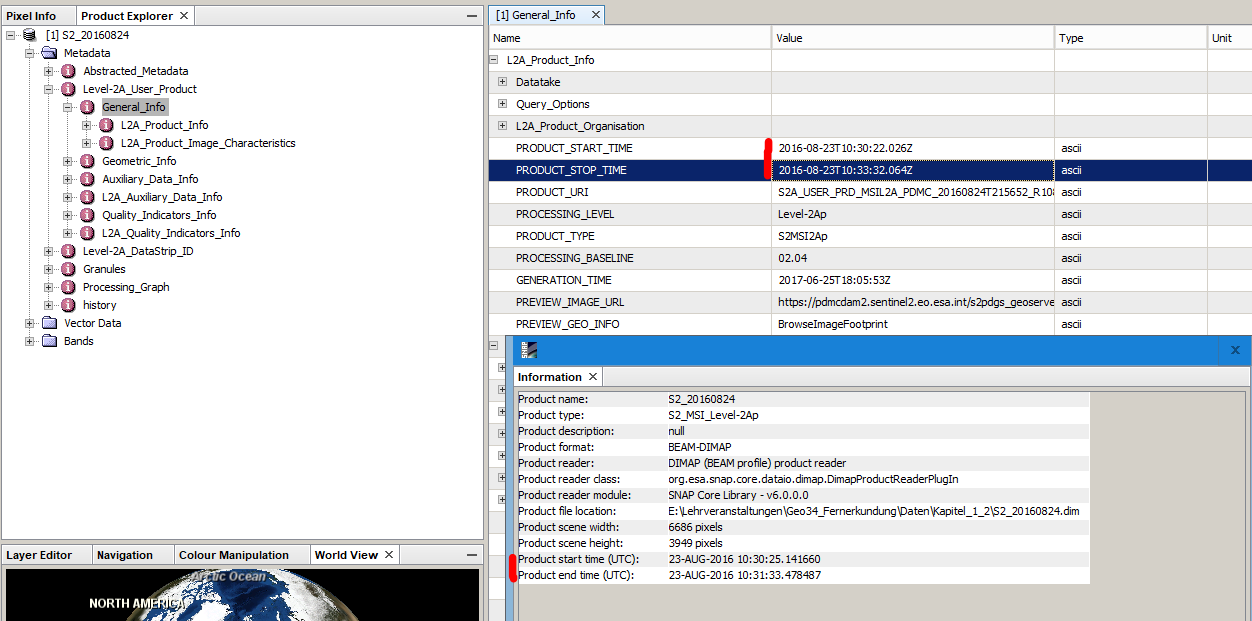
I have a question regarding metadata of the time of image acquisition. Why is there a difference betwen the metadata and the information in the info menu regarding start and end/stop time? Do end time and stop time mean different things?
Your belief in the breadth of my knowledge is flattering However, I’m going to disappoint you; I don’t have an answer
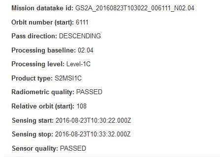
I do know that 3 minutes and 10 seconds is a bit long for the duration of a single Tile (it would make mores sense if it were the Datastrip duration!)
I presume the L2A is one processed using the plugin in SNAP? If so, I shall try to replicate the issue.
thanks a lot - no worries. My students found this out before I did, so I was also kind of surprised. But I guessed the same, the shorter time is more reasonable.
I only resampled the scene to 10 m and made a subset (all in SNAP) so we could directly start with the image in the course.
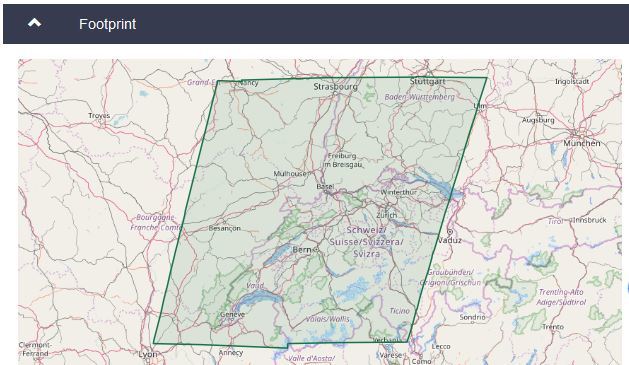
S2A_USER_PRD_MSIL2A_PDMC_20160824T215652_R108_V20160823T103022_20160823T103332.SAFE
thank you for this information. I too need the exact sensing time for each tile. Do you know how one can get the coordinates for the start of the datatake, to perform the estimation you describe?
Dear readers, would you mind to describe, what is “datake (orbit) sensing time”? And what the difference “between remote sensing time” and “datake time”? I didn’t find no answers in national and foreign literature yet.


 However, I’m going to disappoint you; I don’t have an answer