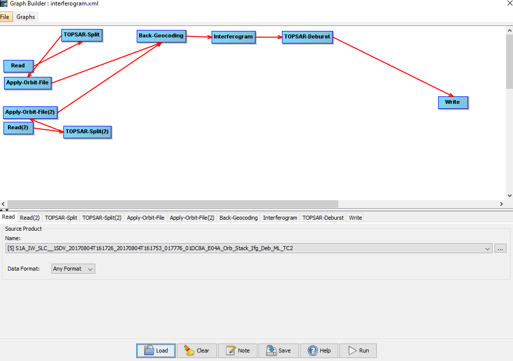
I did some coherence processing (Coherence Estimation) on coregistered stacks.
The next steps were Deburst > Multilooking > Speckle Filtering > Terrain Correction (EPSG 32632, 10m Pixel Spacing)
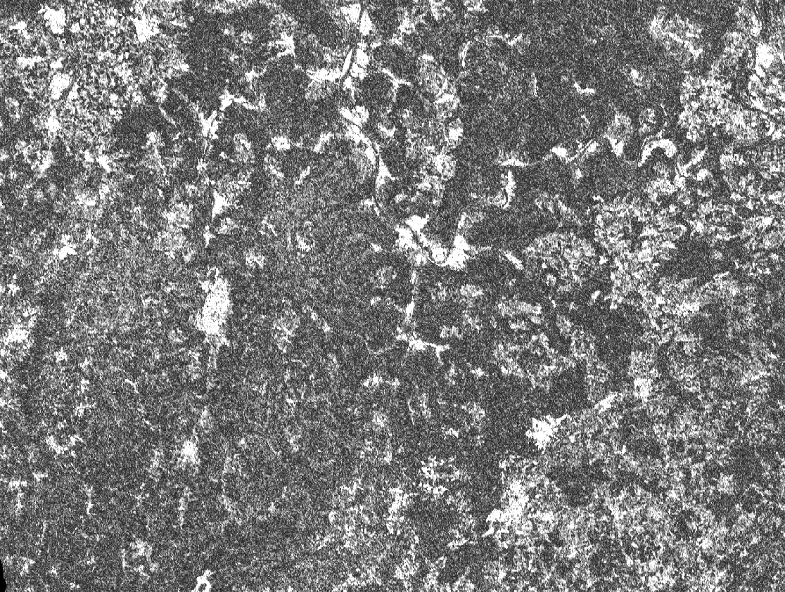
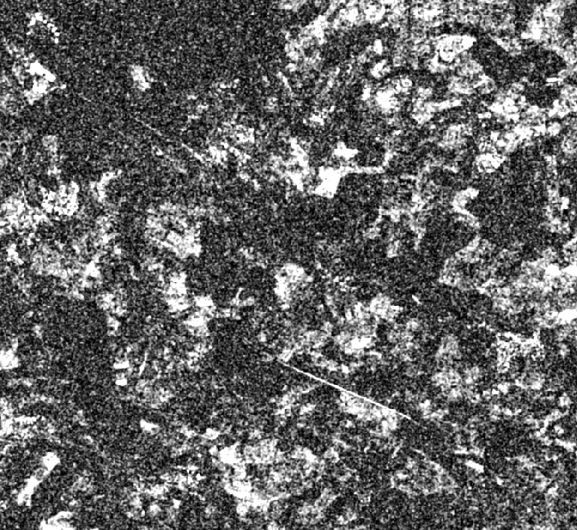
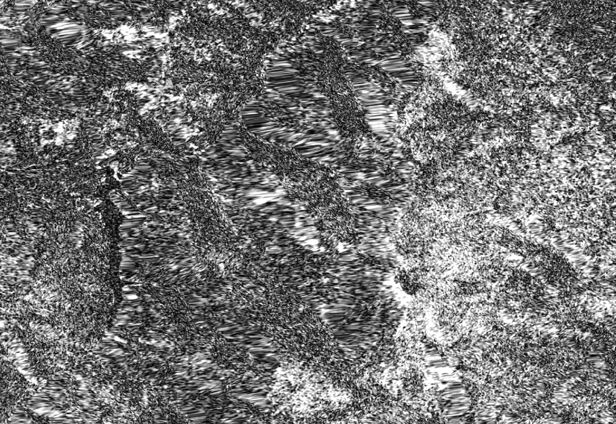
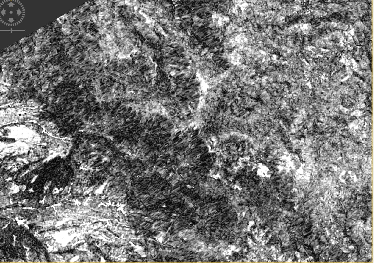
However, I got those artefacts in my data (in both VH and VV):
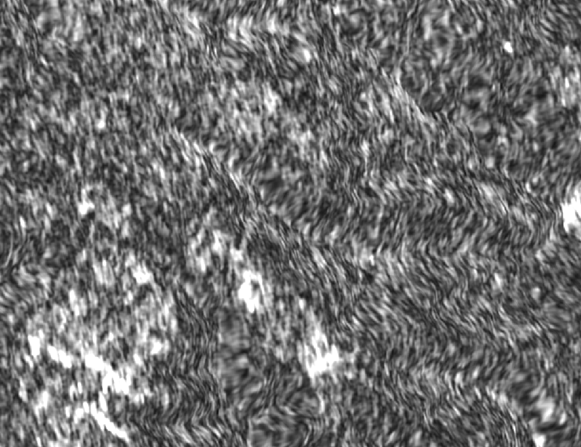
I processed about 22 coherences and they all show these strange artefacts. I also skipped the speckle filter, but still no improvement. Before applying the Terrain Correction (after Multilook), the data looks correct:
I also tried different windows sizes for range and azimuth. I also tried it with 20m resolution and different map projections. I even tried SRTM 1 sec HGT and SRTM 3sec.
Does anyone know what the problem here is?
Thank you for your help!
I think this is just what Terrain Correction does. It stretches the image so it is no longer in slant geometry but is correctly aligned to the earth’s topography. This leads to shifting of areas according to their foreshortening effect.
Speckle filtering is for intensity data, not coherence data. The speckle filter is adaptive to the statistical model that describes [multi-looked] intensity. AFAIK, there isn’t anything equivalent for coherence (?).
well you could, technically, also filter coherence but that doesn’t change the quality of the interferometric phase underneath. The Goldstein Phase Filter smoothes interferogram fringes of high coherence areas. But as you say, that doesn’t make bad quality areas better either.
you can try another image pair. Maybe change ascending/descending acquisitions to see if another look direction gives better results after terrain correction.
It looks like your coherence-images are quite noisy in the low-coherence areas. Terrain-corrected noise does not look very pleasing.
You could try the following:
Increase the size of the coherence-estimator window.
Use multitemporal-filtering to reduce noise in the coherence-stack (this takes some experimentation to see what works - I got good results with using 5x5 pixel median filtering in the multitemporal filter)
The stripes are in areas where the terrain correction geometrically corrects areas of foreshortening. At these slopes the sampling is not dense enough to provide actual values so these are just geometrically interpolated. Same example here.
Have you tried the suggestions of @mengdahl from above?