I am looking to get the local incidence angle for different parcels of land so I want to be able to export a raster containing the incidence angles as pixel values.
From this link I see I should "apply Range Doppler Terrain Correction on your data, select WGS84 as output coordinate system (already predefined) and include the local incidence angle in the output " but I am not sure how to translate this into a python script. I have this so far:
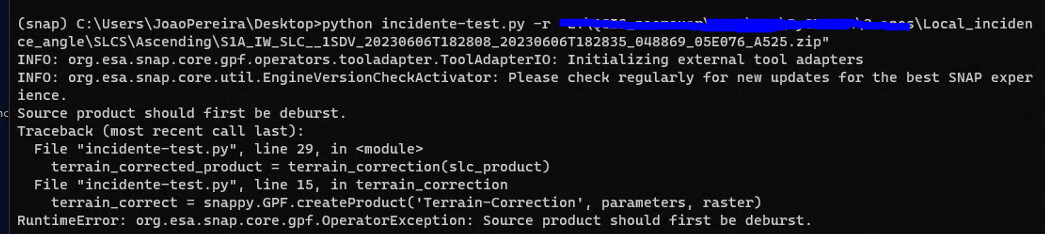
def terrain_correction(raster):
    # doppler range terrain correction
    # default projection is WGS84

    parameters = snappy.HashMap()
    parameters.put('demName', 'SRTM 3Sec')  # DEM will be automatically downloaded
    parameters.put('imgResamplingMethod', 'BILINEAR_INTERPOLATION')    # default
    parameters.put('nodataValueAtSea', False)   # do not mask out areas without elevation
    parameters.put('saveSelectedSourceBand', True)
    terrain_correct = snappy.GPF.createProduct('Terrain-Correction', parameters, raster)
    print("[INFO] terrain corrected")

    return terrain_correct

continue on with preprocessing
But I can’t find anywhere stating how to set the including local incidence angle as a parameter.