Once I have carried out a series of pre-processing steps for a Sentinel 1A IW GRD product (Apply Orbit File, Thermal Noise Removal, Calibration, Speckle Filter & Terrain Correction), there are areas of no data that were not on the original intensity image.
I have tried different speckle filters and still the same issue. These areas seem to correlate with flooding at that time, but I’ve never had this issue when looking at flooding previously.
I have also tried this with another date with the same issue.

I came across these issues in version 10.0. Just reverted the previous version 8.0 & the issue was resolved
@jun_lu can you have a look?
Could you provide the product name and the processing graph so that we can reproduce the issue? Thank you.
Hi I’m using SNAP Desktop 8.0 now but the error was occurring with version 10.0.
Graph used attached
RUS_training_graph_nospecklefilter.xml (6.4 KB)
A Jira ticket (Jira) has been created to track the issue. We will look into it. Thank you.
We believe the no data pixels in the terrain corrected image are caused by the zeros in the SRTM 1sec DEM tiles. For example, the red area in the image below indicates the zero elevation area in tile N50E002.SRTMGL1.hgt.zip and N51E002.SRTMGL1.hgt.zip.
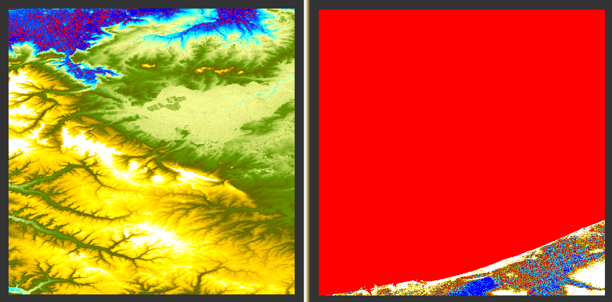
When “Mask out areas without elevation” option is selected in terrain correction operator, pixels with zero elevations are set to no data. I suggest using the Copernicus 30m DEM instead to avoid the no data problem.
Ok thanks. will try this