Hi all,
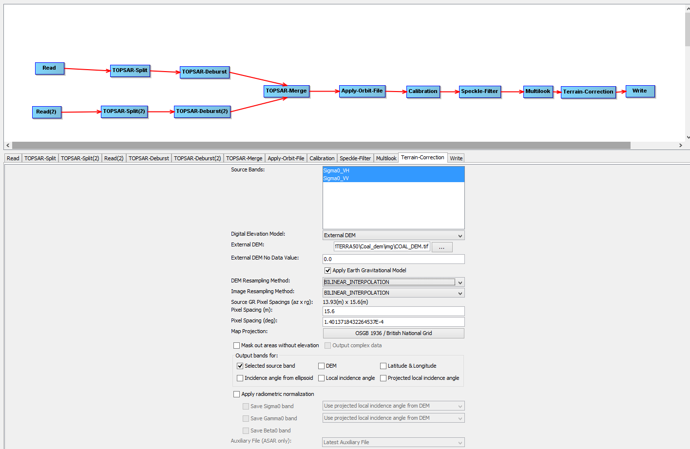
We are working using Sentinel 1 imagery for classification purposes. The problem comes at the Terrain correction stage of this graph:
We used our DEM of the AOI projection set to EPSG27700 (British National Grid)
The tool works but the result is shifted several meters. The parameters selected are:
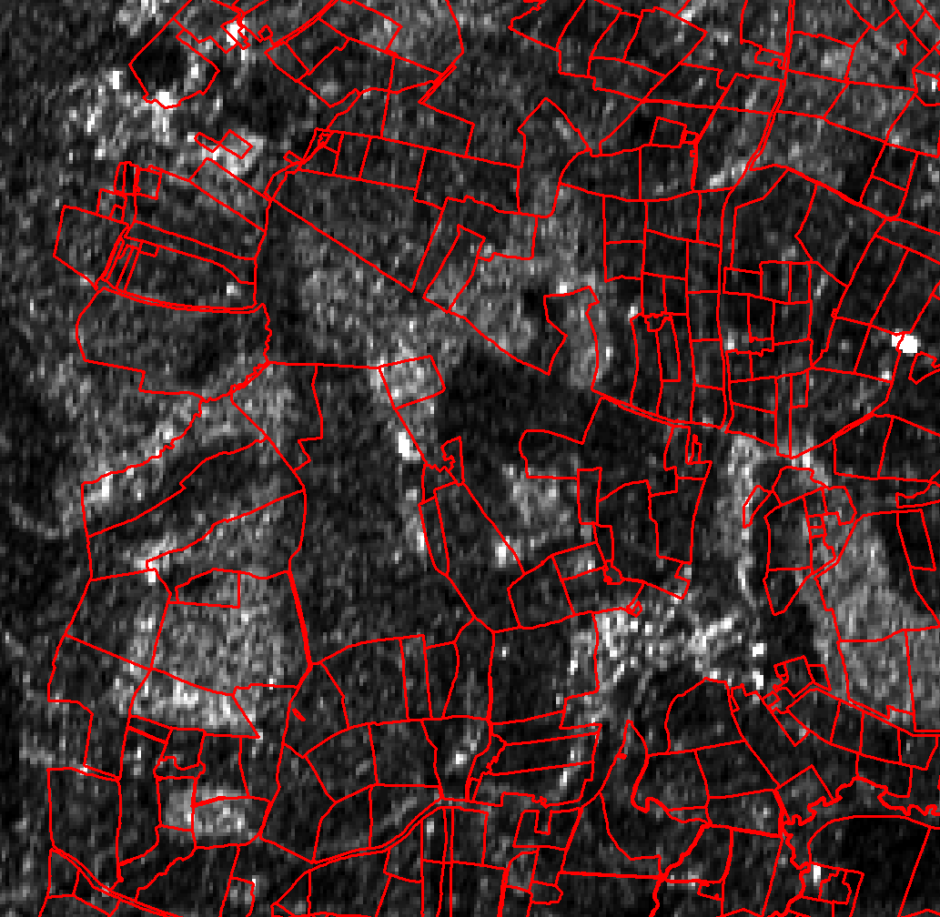
The results (we can see how those lines representing field boundaries are displaced several meters):
Could anyone help us out?
The product used is:
S1A_IW_SLC__1SDV_20160420T062231_20160420T062258_010901_01055B_7E13
Regards,
I too have noticed this shift when trying to project directly to OSGB within SNAP. It doesn’t seem to be product dependant.
Projecting to Auto UTM or WGS84 and then re-projecting to OSGB in GDAL produces the expected result.
Perhaps the OSGB in SNAP is not defined correctly?
ABraun
April 18, 2017, 5:11pm
4
I’m not sure if I understood you right, but the DEM must be in WGS84 for Terrain Correction, regardless of the chosen output projection.
I have tried using the SRTM Auto-Download (both 3-sec and 1-sec) and an external DEM in WGS84 to do the Terrain Correction.
When setting the output Map Projection to WGS84 or AutoUTM, the S1 scene is projected as expected. I can even reproject this data to OSGB using GDAL and it remains in the correct location. However, when Terrain Correcting directly to OSGB (EPSG:27700) in SNAP, there seems to be an offset that @msanabria is also experiencing.
Could this have something to do with the Datum?
Thanks a million,
Projecting to Auto UTM or WGS84 and then re-projecting to OSGB in GDAL made it work as expected.
Regarding the software, I still do not understand what could be the reason.
Thanks again.
I wonder if “Apply the Earth Gravitational Model” has something to do with the issue.
maawoo
December 23, 2021, 11:56am
9
Digging this thread out, as this issue with EPSG 27700 still occurs in the wild:
opened 02:45PM - 15 Dec 21 UTC
bug
- which operating system are you using?
Ubuntu 20.04.3
- which environment i… s pyroSAR running in? anaconda environment
- which version of pyroSAR are you using? 0.14
- which function of pyroSAR did you call with which parameters? geocode, with external DEM
This might be a quick one, and maybe just needs a sentence added to documentation, but I noticed a ~100-150m offset in GRD data processed with the geocode function, with the range-doppler terrain correction. I'm using an external DEM, which links to a copy of the copernicus GLO30 DEM.
In my initial attempt, I had externalDEMApplyEGM=True (the default). I ended up with a similar offset using the default SRTM DEM, rather than an external DEM. After some exploration of different DEMs and keyword argument combinations, I resolved the offset issue by setting externalDEMApplyEGM=False in the geocode function. Is this expected behaviour for this function or have I missed something (quite likely!)?
Thanks again for a super-useful package!
Best wishes,
David